You are here: Home > Network List > G - GEOSCOPE Stations List
> Station RER Riviere de l'Est, La Reunion (Indian Ocean) > Earthquake Result Viewer
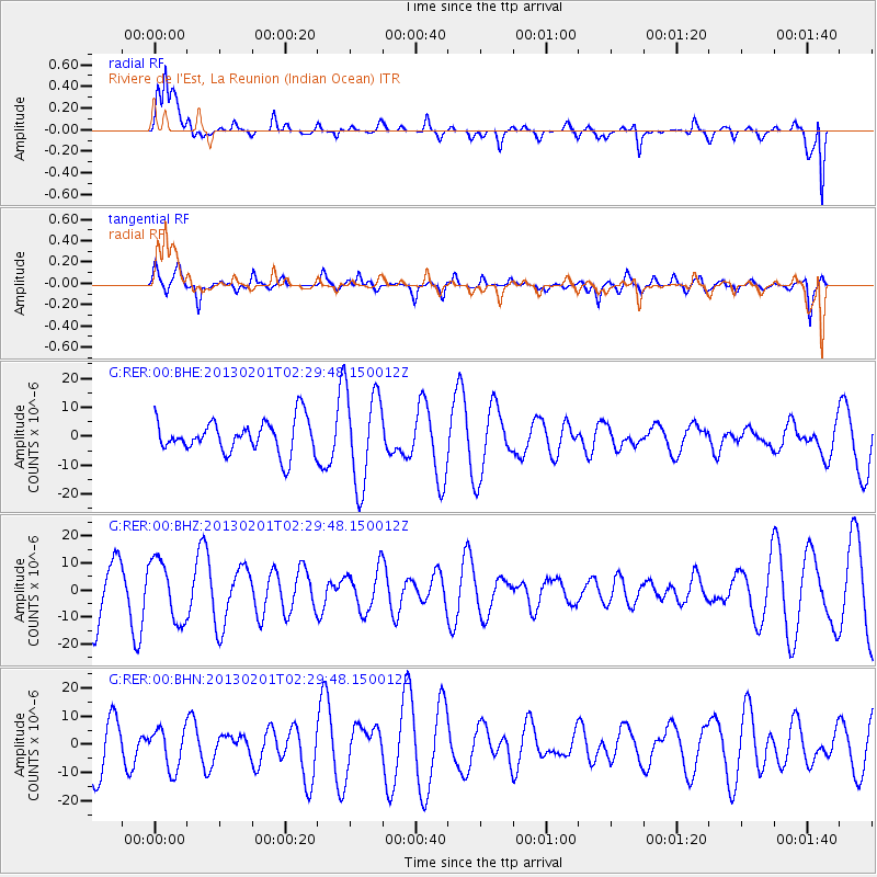
RER Riviere de l'Est, La Reunion (Indian Ocean) - Earthquake Result Viewer
*The percent match for this event was below the threshold and hence no stack was calculated.
| Earthquake location: |
Eastern New Guinea Reg., P.N.G. |
| Earthquake latitude/longitude: |
-7.0/147.7 |
| Earthquake time(UTC): |
2013/02/01 (032) 02:17:27 GMT |
| Earthquake Depth: |
44 km |
| Earthquake Magnitude: |
6.0 MS, 5.2 MB, 5.8 MW, 5.8 MW |
| Earthquake Catalog/Contributor: |
WHDF/NEIC |
|
| Network: |
G GEOSCOPE |
| Station: |
RER Riviere de l'Est, La Reunion (Indian Ocean) |
| Lat/Lon: |
21.16 S/55.75 E |
| Elevation: |
834 m |
|
| Distance: |
89.3 deg |
| Az: |
248.896 deg |
| Baz: |
97.141 deg |
| Ray Param: |
$rayparam |
*The percent match for this event was below the threshold and hence was not used in the summary stack. |
|
| Radial Match: |
58.11144 % |
| Radial Bump: |
400 |
| Transverse Match: |
57.675682 % |
| Transverse Bump: |
381 |
| SOD ConfigId: |
494114 |
| Insert Time: |
2013-04-27 05:26:35.458 +0000 |
| GWidth: |
2.5 |
| Max Bumps: |
400 |
| Tol: |
0.001 |
|
Signal To Noise
| Channel | StoN | STA | LTA |
| G:RER:00:BHZ:20130201T02:29:48.150012Z | 1.1079308 | 1.1190334E-5 | 1.010021E-5 |
| G:RER:00:BHN:20130201T02:29:48.150012Z | 0.89988756 | 7.2765806E-6 | 8.0861E-6 |
| G:RER:00:BHE:20130201T02:29:48.150012Z | 2.9325495 | 1.6722452E-5 | 5.70236E-6 |
| Arrivals |
| Ps | |
| PpPs | |
| PsPs/PpSs | |


