
BDFB Brasilia, Brazil - Earthquake Result Viewer
| ||||||||||||||||||
| ||||||||||||||||||
| ||||||||||||||||||
|
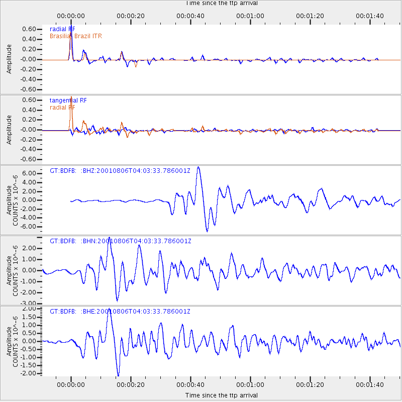
Signal To Noise
| Channel | StoN | STA | LTA |
| GT:BDFB: :BHN:20010806T04:03:33.786001Z | 3.4839802 | 4.631254E-7 | 1.3292997E-7 |
| GT:BDFB: :BHE:20010806T04:03:33.786001Z | 6.478691 | 4.2541754E-7 | 6.5664125E-8 |
| GT:BDFB: :BHZ:20010806T04:03:33.786001Z | 9.127784 | 1.3201026E-6 | 1.4462465E-7 |
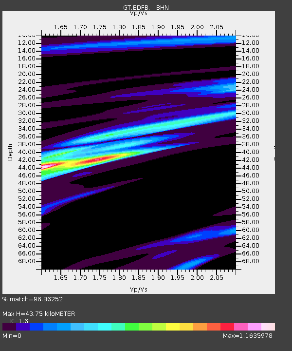
| Arrivals | |
| Ps | 4.3 SECOND |
| PpPs | 17 SECOND |
| PsPs/PpSs | 21 SECOND |

