You are here: Home > Network List > CI - Caltech Regional Seismic Network Stations List
> Station MPP McPhearson Peak > Earthquake Result Viewer
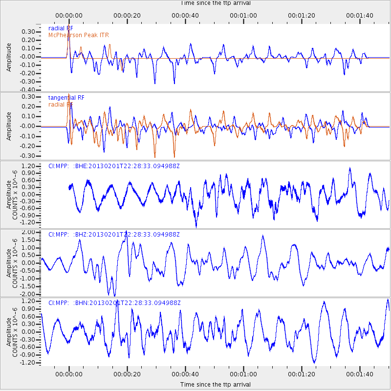
MPP McPhearson Peak - Earthquake Result Viewer
*The percent match for this event was below the threshold and hence no stack was calculated.
| Earthquake location: |
Santa Cruz Islands |
| Earthquake latitude/longitude: |
-10.9/165.4 |
| Earthquake time(UTC): |
2013/02/01 (032) 22:16:34 GMT |
| Earthquake Depth: |
10 km |
| Earthquake Magnitude: |
6.3 MS, 5.3 MB, 6.3 MW, 6.3 MW |
| Earthquake Catalog/Contributor: |
WHDF/NEIC |
|
| Network: |
CI Caltech Regional Seismic Network |
| Station: |
MPP McPhearson Peak |
| Lat/Lon: |
34.89 N/119.81 W |
| Elevation: |
1739 m |
|
| Distance: |
84.0 deg |
| Az: |
52.912 deg |
| Baz: |
252.385 deg |
| Ray Param: |
$rayparam |
*The percent match for this event was below the threshold and hence was not used in the summary stack. |
|
| Radial Match: |
68.05595 % |
| Radial Bump: |
400 |
| Transverse Match: |
66.75188 % |
| Transverse Bump: |
400 |
| SOD ConfigId: |
494114 |
| Insert Time: |
2013-04-27 05:44:24.233 +0000 |
| GWidth: |
2.5 |
| Max Bumps: |
400 |
| Tol: |
0.001 |
|
Signal To Noise
| Channel | StoN | STA | LTA |
| CI:MPP: :BHZ:20130201T22:28:33.094988Z | 2.8016074 | 7.765698E-7 | 2.7718724E-7 |
| CI:MPP: :BHN:20130201T22:28:33.094988Z | 0.49188042 | 2.601484E-7 | 5.2888544E-7 |
| CI:MPP: :BHE:20130201T22:28:33.094988Z | 0.64408594 | 2.3692772E-7 | 3.6785107E-7 |
| Arrivals |
| Ps | |
| PpPs | |
| PsPs/PpSs | |


