You are here: Home > Network List > TA - USArray Transportable Network (new EarthScope stations) Stations List
> Station T25A Trinidad, CO, USA > Earthquake Result Viewer
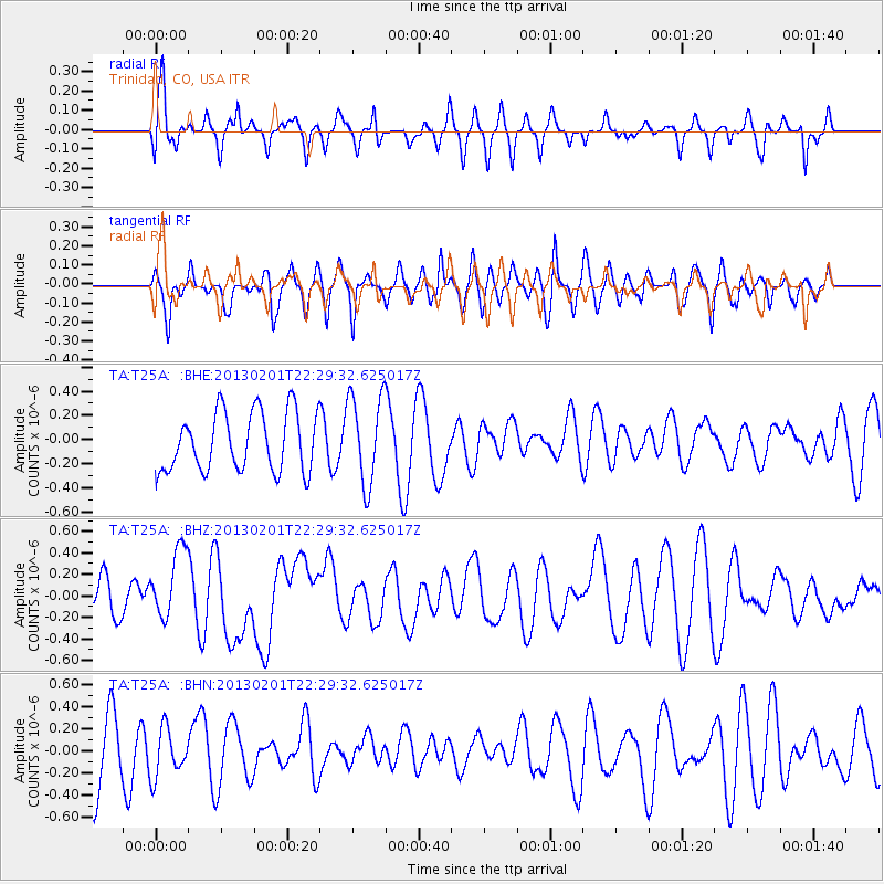
T25A Trinidad, CO, USA - Earthquake Result Viewer
*The percent match for this event was below the threshold and hence no stack was calculated.
| Earthquake location: |
Santa Cruz Islands |
| Earthquake latitude/longitude: |
-10.9/165.4 |
| Earthquake time(UTC): |
2013/02/01 (032) 22:16:34 GMT |
| Earthquake Depth: |
10 km |
| Earthquake Magnitude: |
6.3 MS, 5.3 MB, 6.3 MW, 6.3 MW |
| Earthquake Catalog/Contributor: |
WHDF/NEIC |
|
| Network: |
TA USArray Transportable Network (new EarthScope stations) |
| Station: |
T25A Trinidad, CO, USA |
| Lat/Lon: |
37.14 N/104.41 W |
| Elevation: |
2017 m |
|
| Distance: |
96.6 deg |
| Az: |
53.565 deg |
| Baz: |
261.436 deg |
| Ray Param: |
$rayparam |
*The percent match for this event was below the threshold and hence was not used in the summary stack. |
|
| Radial Match: |
57.256584 % |
| Radial Bump: |
400 |
| Transverse Match: |
46.057274 % |
| Transverse Bump: |
400 |
| SOD ConfigId: |
494114 |
| Insert Time: |
2013-04-27 05:48:06.325 +0000 |
| GWidth: |
2.5 |
| Max Bumps: |
400 |
| Tol: |
0.001 |
|
Signal To Noise
| Channel | StoN | STA | LTA |
| TA:T25A: :BHZ:20130201T22:29:32.625017Z | 2.211363 | 3.2506563E-7 | 1.4699785E-7 |
| TA:T25A: :BHN:20130201T22:29:32.625017Z | 0.8939794 | 2.1671497E-7 | 2.4241606E-7 |
| TA:T25A: :BHE:20130201T22:29:32.625017Z | 1.5311164 | 3.713007E-7 | 2.4250326E-7 |
| Arrivals |
| Ps | |
| PpPs | |
| PsPs/PpSs | |


