You are here: Home > Network List > TA - USArray Transportable Network (new EarthScope stations) Stations List
> Station HDA Harding Lake, AK, USA > Earthquake Result Viewer
HDA Harding Lake, AK, USA - Earthquake Result Viewer

| Earthquake location: |
Santa Cruz Islands |
| Earthquake latitude/longitude: |
-11.1/165.4 |
| Earthquake time(UTC): |
2013/02/01 (032) 22:18:33 GMT |
| Earthquake Depth: |
10 km |
| Earthquake Magnitude: |
5.7 MB, 6.4 MW, 6.3 MW |
| Earthquake Catalog/Contributor: |
WHDF/NEIC |
|
| Network: |
TA USArray Transportable Network (new EarthScope stations) |
| Station: |
HDA Harding Lake, AK, USA |
| Lat/Lon: |
64.41 N/146.95 W |
| Elevation: |
437 m |
|
| Distance: |
83.4 deg |
| Az: |
18.857 deg |
| Baz: |
226.922 deg |
| Ray Param: |
0.046194036 |
| Estimated Moho Depth: |
26.25 km |
| Estimated Crust Vp/Vs: |
1.79 |
| Assumed Crust Vp: |
6.566 km/s |
| Estimated Crust Vs: |
3.679 km/s |
| Estimated Crust Poisson's Ratio: |
0.27 |
|
| Radial Match: |
85.48777 % |
| Radial Bump: |
400 |
| Transverse Match: |
60.843895 % |
| Transverse Bump: |
400 |
| SOD ConfigId: |
494114 |
| Insert Time: |
2013-04-27 05:55:28.211 +0000 |
| GWidth: |
2.5 |
| Max Bumps: |
400 |
| Tol: |
0.001 |
|
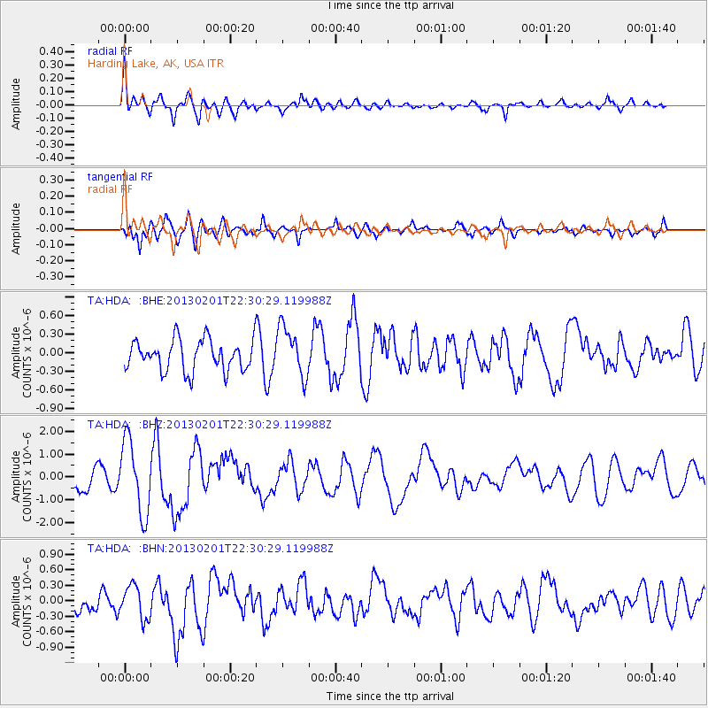
Signal To Noise
| Channel | StoN | STA | LTA |
| TA:HDA: :BHZ:20130201T22:30:29.119988Z | 3.9391139 | 1.6138952E-6 | 4.097102E-7 |
| TA:HDA: :BHN:20130201T22:30:29.119988Z | 1.588829 | 3.2336945E-7 | 2.035269E-7 |
| TA:HDA: :BHE:20130201T22:30:29.119988Z | 1.6403676 | 4.1024813E-7 | 2.5009524E-7 |
| Arrivals |
| Ps | 3.2 SECOND |
| PpPs | 11 SECOND |
| PsPs/PpSs | 14 SECOND |


