You are here: Home > Network List > IW - Intermountain West Stations List
> Station MOOW Moose Ponds, Wyoming, USA > Earthquake Result Viewer
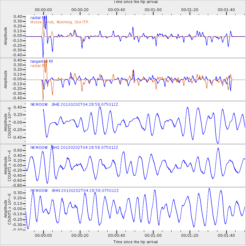
MOOW Moose Ponds, Wyoming, USA - Earthquake Result Viewer
*The percent match for this event was below the threshold and hence no stack was calculated.
| Earthquake location: |
Santa Cruz Islands |
| Earthquake latitude/longitude: |
-11.0/165.4 |
| Earthquake time(UTC): |
2013/02/02 (033) 04:16:17 GMT |
| Earthquake Depth: |
22 km |
| Earthquake Magnitude: |
5.6 MS, 5.4 MB, 5.8 MW, 5.9 MW |
| Earthquake Catalog/Contributor: |
WHDF/NEIC |
|
| Network: |
IW Intermountain West |
| Station: |
MOOW Moose Ponds, Wyoming, USA |
| Lat/Lon: |
43.75 N/110.74 W |
| Elevation: |
2128 m |
|
| Distance: |
93.1 deg |
| Az: |
46.192 deg |
| Baz: |
257.932 deg |
| Ray Param: |
$rayparam |
*The percent match for this event was below the threshold and hence was not used in the summary stack. |
|
| Radial Match: |
73.6509 % |
| Radial Bump: |
400 |
| Transverse Match: |
43.01715 % |
| Transverse Bump: |
400 |
| SOD ConfigId: |
494114 |
| Insert Time: |
2013-04-27 06:01:47.914 +0000 |
| GWidth: |
2.5 |
| Max Bumps: |
400 |
| Tol: |
0.001 |
|
Signal To Noise
| Channel | StoN | STA | LTA |
| IW:MOOW: :BHZ:20130202T04:28:58.075012Z | 2.870096 | 5.058607E-7 | 1.7625219E-7 |
| IW:MOOW: :BHN:20130202T04:28:58.075012Z | 0.4988033 | 7.171735E-8 | 1.4377883E-7 |
| IW:MOOW: :BHE:20130202T04:28:58.075012Z | 2.0547729 | 2.6369116E-7 | 1.2833104E-7 |
| Arrivals |
| Ps | |
| PpPs | |
| PsPs/PpSs | |


