
BGCA Bogoin, Central African Republic - Earthquake Result Viewer
| ||||||||||||||||||
| ||||||||||||||||||
| ||||||||||||||||||
|
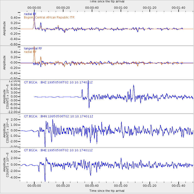
Signal To Noise
| Channel | StoN | STA | LTA |
| GT:BGCA: :BHN:19950506T02:10:10.174011Z | 3.3854759 | 3.4054307E-7 | 1.00589425E-7 |
| GT:BGCA: :BHE:19950506T02:10:10.174011Z | 4.9503365 | 6.122644E-7 | 1.2368136E-7 |
| GT:BGCA: :BHZ:19950506T02:10:10.174011Z | 13.957467 | 1.654318E-6 | 1.18525655E-7 |
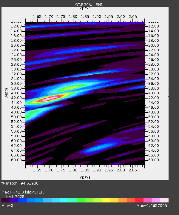
| Arrivals | |
| Ps | 4.6 SECOND |
| PpPs | 17 SECOND |
| PsPs/PpSs | 21 SECOND |

