You are here: Home > Network List > TA - USArray Transportable Network (new EarthScope stations) Stations List
> Station E45A Wooded Hills, Hulbert, MI, USA > Earthquake Result Viewer
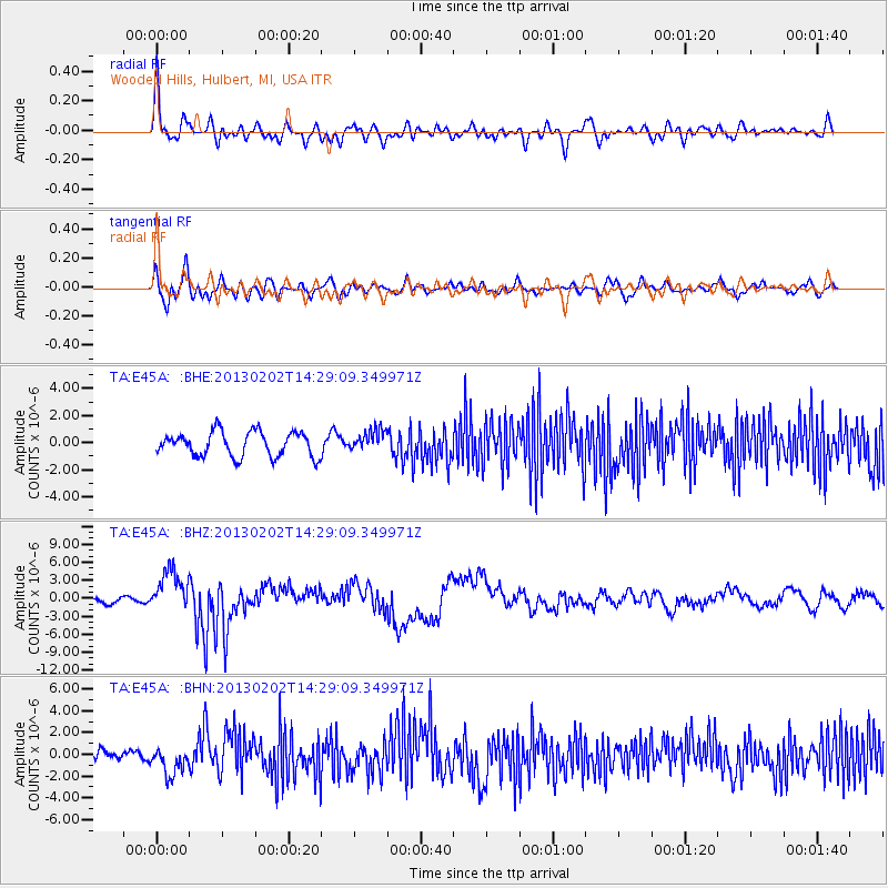
E45A Wooded Hills, Hulbert, MI, USA - Earthquake Result Viewer
*The percent match for this event was below the threshold and hence no stack was calculated.
| Earthquake location: |
Hokkaido, Japan Region |
| Earthquake latitude/longitude: |
42.8/143.1 |
| Earthquake time(UTC): |
2013/02/02 (033) 14:17:35 GMT |
| Earthquake Depth: |
107 km |
| Earthquake Magnitude: |
6.4 MB, 6.9 MW, 6.9 MW |
| Earthquake Catalog/Contributor: |
WHDF/NEIC |
|
| Network: |
TA USArray Transportable Network (new EarthScope stations) |
| Station: |
E45A Wooded Hills, Hulbert, MI, USA |
| Lat/Lon: |
46.36 N/85.18 W |
| Elevation: |
251 m |
|
| Distance: |
81.5 deg |
| Az: |
31.512 deg |
| Baz: |
326.241 deg |
| Ray Param: |
$rayparam |
*The percent match for this event was below the threshold and hence was not used in the summary stack. |
|
| Radial Match: |
74.619 % |
| Radial Bump: |
400 |
| Transverse Match: |
61.62364 % |
| Transverse Bump: |
400 |
| SOD ConfigId: |
494114 |
| Insert Time: |
2013-04-27 06:39:44.746 +0000 |
| GWidth: |
2.5 |
| Max Bumps: |
400 |
| Tol: |
0.001 |
|
Signal To Noise
| Channel | StoN | STA | LTA |
| TA:E45A: :BHZ:20130202T14:29:09.349971Z | 4.447292 | 3.4358281E-6 | 7.7256635E-7 |
| TA:E45A: :BHN:20130202T14:29:09.349971Z | 2.1918175 | 1.2544383E-6 | 5.7232785E-7 |
| TA:E45A: :BHE:20130202T14:29:09.349971Z | 0.8916479 | 7.952294E-7 | 8.918649E-7 |
| Arrivals |
| Ps | |
| PpPs | |
| PsPs/PpSs | |


