BGCA Bogoin, Central African Republic - Earthquake Result Viewer
Earthquake location: Northern Mid-Atlantic Ridge
Earthquake latitude/longitude: 29.9/-42.9
Earthquake time(UTC): 1996/12/09 (344) 11:28:48 GMT
Earthquake Depth: 10 km
Earthquake Magnitude: 5.9 MB, 6.1 MS, 6.0 UNKNOWN, 5.9 MW
Earthquake Catalog/Contributor: WHDF/NEIC
Network: GT Global Telemetered Seismograph Network (USAF/USGS)
Station: BGCA Bogoin, Central African Republic
Lat/Lon: 5.18 N/18.42 E
Elevation: 676 m
Distance: 62.6 deg
Az: 100.327 deg
Baz: 300.891 deg
Ray Param: 0.06011889
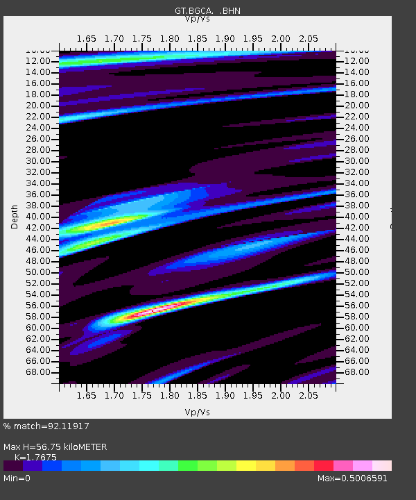
Estimated Moho Depth: 56.75 km
Estimated Crust Vp/Vs: 1.77
Assumed Crust Vp: 6.642 km/s
Estimated Crust Vs: 3.758 km/s
Estimated Crust Poisson's Ratio: 0.26
Radial Match: 92.11917 %
Radial Bump: 242
Transverse Match: 77.05781 %
Transverse Bump: 400
SOD ConfigId: 6273
Insert Time: 2010-02-27 01:38:11.417 +0000
GWidth: 2.5
Max Bumps: 400
Tol: 0.001

Signal To Noise

ChannelStoNSTALTA
GT:BGCA: :BHN:19961209T11:38:41.732996Z1.00583794.061906E-84.0383302E-8
GT:BGCA: :BHE:19961209T11:38:41.732996Z2.55572631.192709E-74.6668106E-8
GT:BGCA: :BHZ:19961209T11:38:41.732996Z4.74451732.5790837E-75.435924E-8
Arrivals
Ps6.9 SECOND
PpPs23 SECOND
PsPs/PpSs29 SECOND