
BGCA Bogoin, Central African Republic - Earthquake Result Viewer
| ||||||||||||||||||
| ||||||||||||||||||
| ||||||||||||||||||
|
Signal To Noise
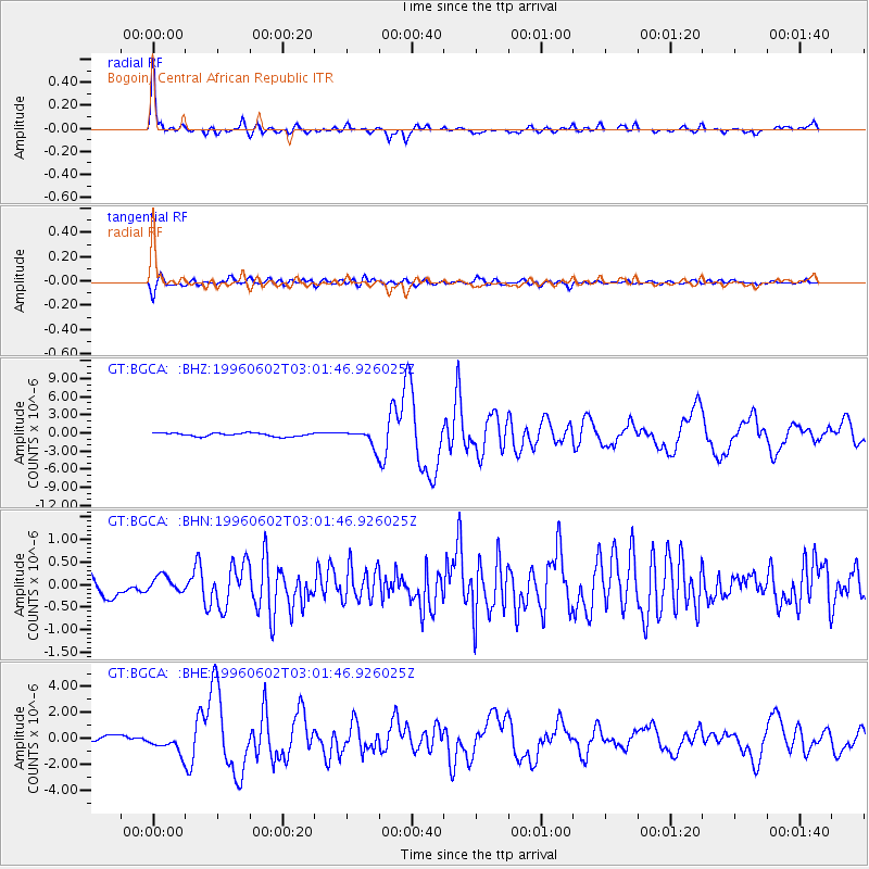
| Channel | StoN | STA | LTA |
| GT:BGCA: :BHN:19960602T03:01:46.926025Z | 0.90111405 | 1.7742221E-7 | 1.9689207E-7 |
| GT:BGCA: :BHE:19960602T03:01:46.926025Z | 3.861391 | 7.3832115E-7 | 1.91206E-7 |
| GT:BGCA: :BHZ:19960602T03:01:46.926025Z | 4.950673 | 1.3743056E-6 | 2.7759972E-7 |
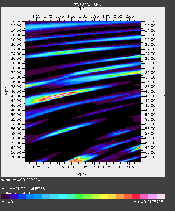
| Arrivals | |
| Ps | 4.9 SECOND |
| PpPs | 16 SECOND |
| PsPs/PpSs | 21 SECOND |

