You are here: Home > Network List > TA - USArray Transportable Network (new EarthScope stations) Stations List
> Station 356A Blackshear, GA, USA > Earthquake Result Viewer
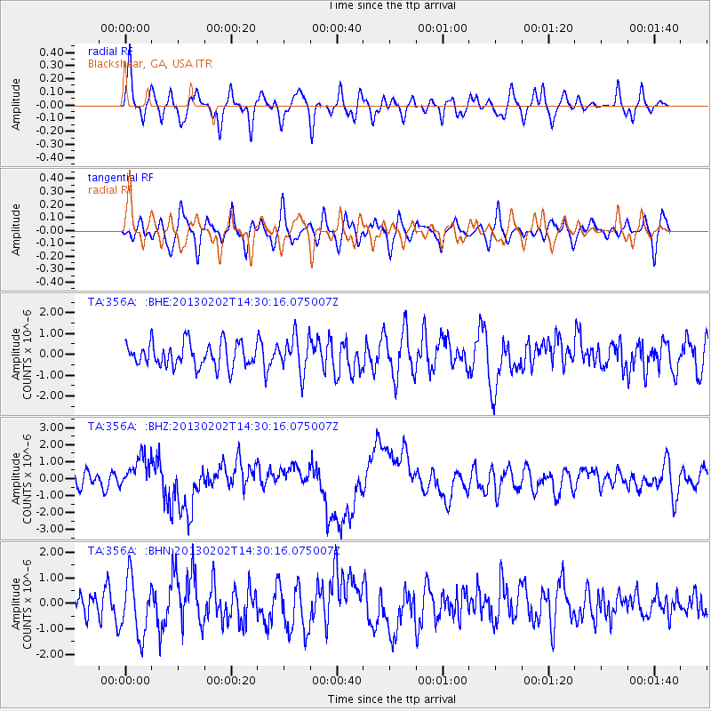
356A Blackshear, GA, USA - Earthquake Result Viewer
*The percent match for this event was below the threshold and hence no stack was calculated.
| Earthquake location: |
Hokkaido, Japan Region |
| Earthquake latitude/longitude: |
42.8/143.1 |
| Earthquake time(UTC): |
2013/02/02 (033) 14:17:35 GMT |
| Earthquake Depth: |
107 km |
| Earthquake Magnitude: |
6.4 MB, 6.9 MW, 6.9 MW |
| Earthquake Catalog/Contributor: |
WHDF/NEIC |
|
| Network: |
TA USArray Transportable Network (new EarthScope stations) |
| Station: |
356A Blackshear, GA, USA |
| Lat/Lon: |
31.32 N/82.13 W |
| Elevation: |
36 m |
|
| Distance: |
95.4 deg |
| Az: |
37.599 deg |
| Baz: |
328.332 deg |
| Ray Param: |
$rayparam |
*The percent match for this event was below the threshold and hence was not used in the summary stack. |
|
| Radial Match: |
58.076252 % |
| Radial Bump: |
400 |
| Transverse Match: |
53.184162 % |
| Transverse Bump: |
400 |
| SOD ConfigId: |
494114 |
| Insert Time: |
2013-04-27 06:46:59.907 +0000 |
| GWidth: |
2.5 |
| Max Bumps: |
400 |
| Tol: |
0.001 |
|
Signal To Noise
| Channel | StoN | STA | LTA |
| TA:356A: :BHZ:20130202T14:30:16.075007Z | 1.8716607 | 9.986755E-7 | 5.335772E-7 |
| TA:356A: :BHN:20130202T14:30:16.075007Z | 2.765422 | 1.1266203E-6 | 4.0739542E-7 |
| TA:356A: :BHE:20130202T14:30:16.075007Z | 1.5296488 | 8.7146316E-7 | 5.6971453E-7 |
| Arrivals |
| Ps | |
| PpPs | |
| PsPs/PpSs | |


