You are here: Home > Network List > TA - USArray Transportable Network (new EarthScope stations) Stations List
> Station S51A Beattyville, KY, USA > Earthquake Result Viewer
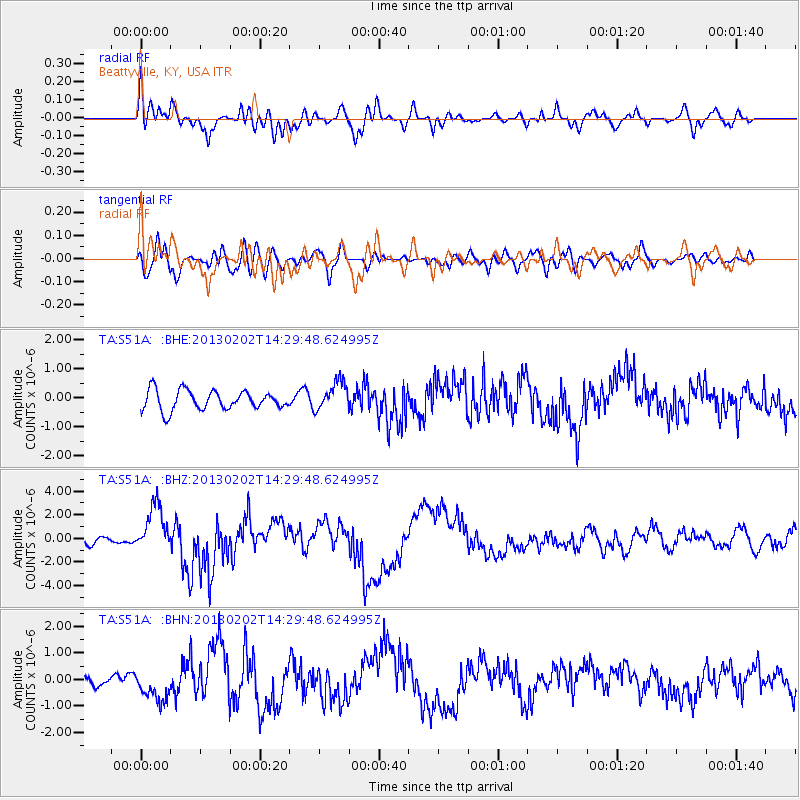
S51A Beattyville, KY, USA - Earthquake Result Viewer
*The percent match for this event was below the threshold and hence no stack was calculated.
| Earthquake location: |
Hokkaido, Japan Region |
| Earthquake latitude/longitude: |
42.8/143.1 |
| Earthquake time(UTC): |
2013/02/02 (033) 14:17:35 GMT |
| Earthquake Depth: |
107 km |
| Earthquake Magnitude: |
6.4 MB, 6.9 MW, 6.9 MW |
| Earthquake Catalog/Contributor: |
WHDF/NEIC |
|
| Network: |
TA USArray Transportable Network (new EarthScope stations) |
| Station: |
S51A Beattyville, KY, USA |
| Lat/Lon: |
37.64 N/83.59 W |
| Elevation: |
286 m |
|
| Distance: |
89.4 deg |
| Az: |
35.284 deg |
| Baz: |
327.602 deg |
| Ray Param: |
$rayparam |
*The percent match for this event was below the threshold and hence was not used in the summary stack. |
|
| Radial Match: |
77.35799 % |
| Radial Bump: |
400 |
| Transverse Match: |
57.37074 % |
| Transverse Bump: |
400 |
| SOD ConfigId: |
494114 |
| Insert Time: |
2013-04-27 06:49:44.968 +0000 |
| GWidth: |
2.5 |
| Max Bumps: |
400 |
| Tol: |
0.001 |
|
Signal To Noise
| Channel | StoN | STA | LTA |
| TA:S51A: :BHZ:20130202T14:29:48.624995Z | 3.76246 | 2.0186442E-6 | 5.365224E-7 |
| TA:S51A: :BHN:20130202T14:29:48.624995Z | 1.6859723 | 5.61584E-7 | 3.3309206E-7 |
| TA:S51A: :BHE:20130202T14:29:48.624995Z | 1.5004951 | 4.9820096E-7 | 3.320244E-7 |
| Arrivals |
| Ps | |
| PpPs | |
| PsPs/PpSs | |


