You are here: Home > Network List > TA - USArray Transportable Network (new EarthScope stations) Stations List
> Station F49A Sandfield, ON, CAN > Earthquake Result Viewer
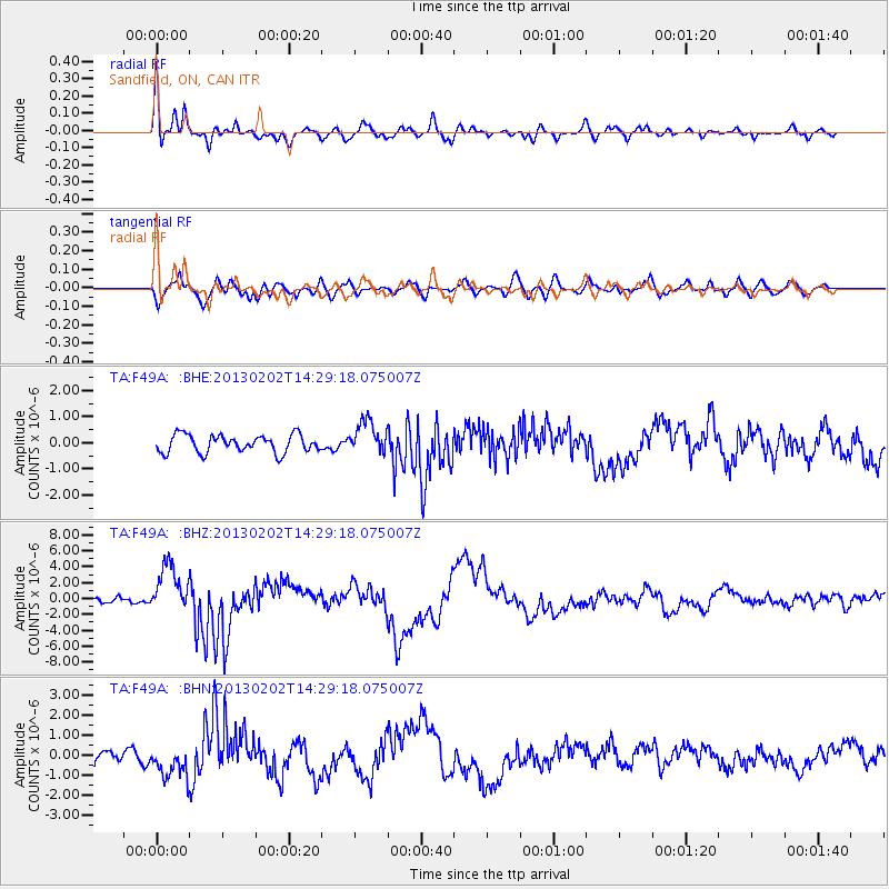
F49A Sandfield, ON, CAN - Earthquake Result Viewer
*The percent match for this event was below the threshold and hence no stack was calculated.
| Earthquake location: |
Hokkaido, Japan Region |
| Earthquake latitude/longitude: |
42.8/143.1 |
| Earthquake time(UTC): |
2013/02/02 (033) 14:17:35 GMT |
| Earthquake Depth: |
107 km |
| Earthquake Magnitude: |
6.4 MB, 6.9 MW, 6.9 MW |
| Earthquake Catalog/Contributor: |
WHDF/NEIC |
|
| Network: |
TA USArray Transportable Network (new EarthScope stations) |
| Station: |
F49A Sandfield, ON, CAN |
| Lat/Lon: |
45.76 N/82.04 W |
| Elevation: |
230 m |
|
| Distance: |
83.1 deg |
| Az: |
29.983 deg |
| Baz: |
328.287 deg |
| Ray Param: |
$rayparam |
*The percent match for this event was below the threshold and hence was not used in the summary stack. |
|
| Radial Match: |
79.39327 % |
| Radial Bump: |
400 |
| Transverse Match: |
74.986626 % |
| Transverse Bump: |
400 |
| SOD ConfigId: |
494114 |
| Insert Time: |
2013-04-27 06:57:29.818 +0000 |
| GWidth: |
2.5 |
| Max Bumps: |
400 |
| Tol: |
0.001 |
|
Signal To Noise
| Channel | StoN | STA | LTA |
| TA:F49A: :BHZ:20130202T14:29:18.075007Z | 6.391934 | 3.0667825E-6 | 4.7978943E-7 |
| TA:F49A: :BHN:20130202T14:29:18.075007Z | 2.0171378 | 8.2870673E-7 | 4.10833E-7 |
| TA:F49A: :BHE:20130202T14:29:18.075007Z | 1.8669341 | 6.2725167E-7 | 3.3597954E-7 |
| Arrivals |
| Ps | |
| PpPs | |
| PsPs/PpSs | |


