You are here: Home > Network List > CI - Caltech Regional Seismic Network Stations List
> Station BAR Barrett, Tecate, CA, USA > Earthquake Result Viewer
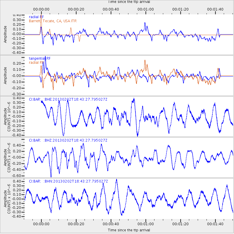
BAR Barrett, Tecate, CA, USA - Earthquake Result Viewer
*The percent match for this event was below the threshold and hence no stack was calculated.
| Earthquake location: |
Southeast Of Honshu, Japan |
| Earthquake latitude/longitude: |
29.3/142.0 |
| Earthquake time(UTC): |
2013/02/02 (033) 18:31:36 GMT |
| Earthquake Depth: |
41 km |
| Earthquake Magnitude: |
5.5 MB, 5.4 MS |
| Earthquake Catalog/Contributor: |
WHDF/NEIC |
|
| Network: |
CI Caltech Regional Seismic Network |
| Station: |
BAR Barrett, Tecate, CA, USA |
| Lat/Lon: |
32.68 N/116.67 W |
| Elevation: |
521 m |
|
| Distance: |
83.3 deg |
| Az: |
56.369 deg |
| Baz: |
300.45 deg |
| Ray Param: |
$rayparam |
*The percent match for this event was below the threshold and hence was not used in the summary stack. |
|
| Radial Match: |
44.988934 % |
| Radial Bump: |
400 |
| Transverse Match: |
52.058735 % |
| Transverse Bump: |
395 |
| SOD ConfigId: |
494114 |
| Insert Time: |
2013-04-27 07:07:34.162 +0000 |
| GWidth: |
2.5 |
| Max Bumps: |
400 |
| Tol: |
0.001 |
|
Signal To Noise
| Channel | StoN | STA | LTA |
| CI:BAR: :BHZ:20130202T18:43:27.795027Z | 0.52281034 | 1.1259179E-7 | 2.1535877E-7 |
| CI:BAR: :BHN:20130202T18:43:27.795027Z | 0.42794865 | 6.430275E-8 | 1.502581E-7 |
| CI:BAR: :BHE:20130202T18:43:27.795027Z | 0.7096678 | 1.3698724E-7 | 1.9303009E-7 |
| Arrivals |
| Ps | |
| PpPs | |
| PsPs/PpSs | |


