You are here: Home > Network List > IC - New China Digital Seismograph Network Stations List
> Station WMQ Urumqi, Xinjiang Province, China > Earthquake Result Viewer
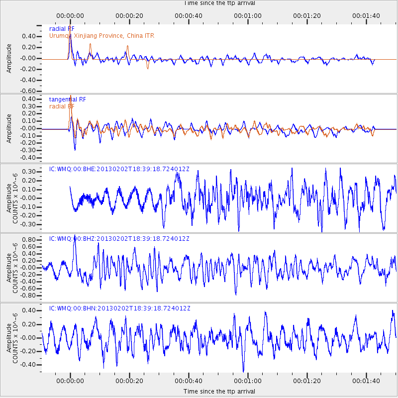
WMQ Urumqi, Xinjiang Province, China - Earthquake Result Viewer
*The percent match for this event was below the threshold and hence no stack was calculated.
| Earthquake location: |
Southeast Of Honshu, Japan |
| Earthquake latitude/longitude: |
29.3/142.0 |
| Earthquake time(UTC): |
2013/02/02 (033) 18:31:36 GMT |
| Earthquake Depth: |
41 km |
| Earthquake Magnitude: |
5.5 MB, 5.4 MS |
| Earthquake Catalog/Contributor: |
WHDF/NEIC |
|
| Network: |
IC New China Digital Seismograph Network |
| Station: |
WMQ Urumqi, Xinjiang Province, China |
| Lat/Lon: |
43.81 N/87.70 E |
| Elevation: |
850 m |
|
| Distance: |
45.2 deg |
| Az: |
303.997 deg |
| Baz: |
89.901 deg |
| Ray Param: |
$rayparam |
*The percent match for this event was below the threshold and hence was not used in the summary stack. |
|
| Radial Match: |
67.106544 % |
| Radial Bump: |
400 |
| Transverse Match: |
62.438816 % |
| Transverse Bump: |
393 |
| SOD ConfigId: |
494114 |
| Insert Time: |
2013-04-27 07:08:48.435 +0000 |
| GWidth: |
2.5 |
| Max Bumps: |
400 |
| Tol: |
0.001 |
|
Signal To Noise
| Channel | StoN | STA | LTA |
| IC:WMQ:00:BHZ:20130202T18:39:18.724012Z | 5.2218094 | 3.4944586E-7 | 6.692046E-8 |
| IC:WMQ:00:BHN:20130202T18:39:18.724012Z | 1.3104026 | 1.4788172E-7 | 1.1285212E-7 |
| IC:WMQ:00:BHE:20130202T18:39:18.724012Z | 1.7514606 | 1.2845662E-7 | 7.334258E-8 |
| Arrivals |
| Ps | |
| PpPs | |
| PsPs/PpSs | |


