You are here: Home > Network List > CN - Canadian National Seismograph Network Stations List
> Station INK INUVIK, NT > Earthquake Result Viewer
INK INUVIK, NT - Earthquake Result Viewer
*The percent match for this event was below the threshold and hence no stack was calculated.
| Earthquake location: |
Samoa Islands Region |
| Earthquake latitude/longitude: |
-14.8/-175.3 |
| Earthquake time(UTC): |
2014/06/29 (180) 15:52:22 GMT |
| Earthquake Depth: |
10 km |
| Earthquake Magnitude: |
6.4 MWW, 6.4 MWB, 6.5 MWC, 6.8 MI |
| Earthquake Catalog/Contributor: |
NEIC PDE/NEIC COMCAT |
|
| Network: |
CN Canadian National Seismograph Network |
| Station: |
INK INUVIK, NT |
| Lat/Lon: |
68.31 N/133.53 W |
| Elevation: |
44 m |
|
| Distance: |
88.1 deg |
| Az: |
14.338 deg |
| Baz: |
220.118 deg |
| Ray Param: |
$rayparam |
*The percent match for this event was below the threshold and hence was not used in the summary stack. |
|
| Radial Match: |
90.767105 % |
| Radial Bump: |
400 |
| Transverse Match: |
78.00139 % |
| Transverse Bump: |
400 |
| SOD ConfigId: |
3390531 |
| Insert Time: |
2019-04-12 14:30:50.530 +0000 |
| GWidth: |
2.5 |
| Max Bumps: |
400 |
| Tol: |
0.001 |
|
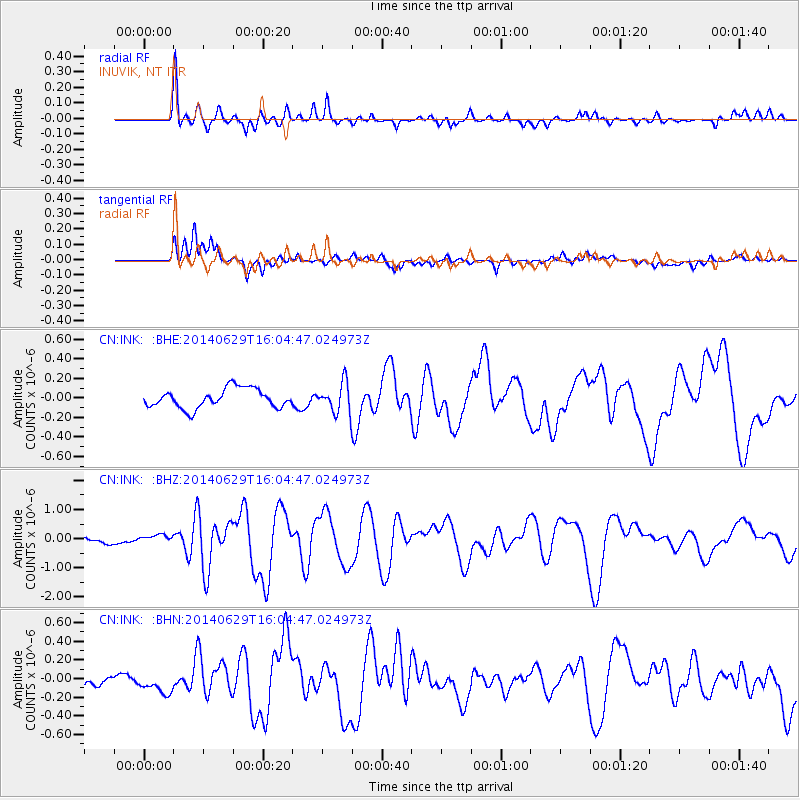
Signal To Noise
| Channel | StoN | STA | LTA |
| CN:INK: :BHZ:20140629T16:04:47.024973Z | 1.2045518 | 1.3942223E-7 | 1.1574615E-7 |
| CN:INK: :BHN:20140629T16:04:47.024973Z | 1.106767 | 1.16873274E-7 | 1.05598794E-7 |
| CN:INK: :BHE:20140629T16:04:47.024973Z | 0.78875655 | 8.2340904E-8 | 1.043933E-7 |
| Arrivals |
| Ps | |
| PpPs | |
| PsPs/PpSs | |


