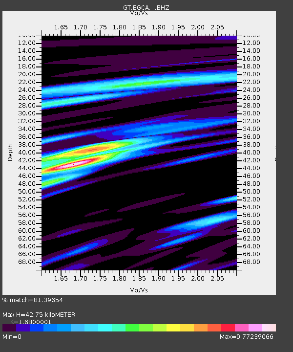
BGCA Bogoin, Central African Republic - Earthquake Result Viewer
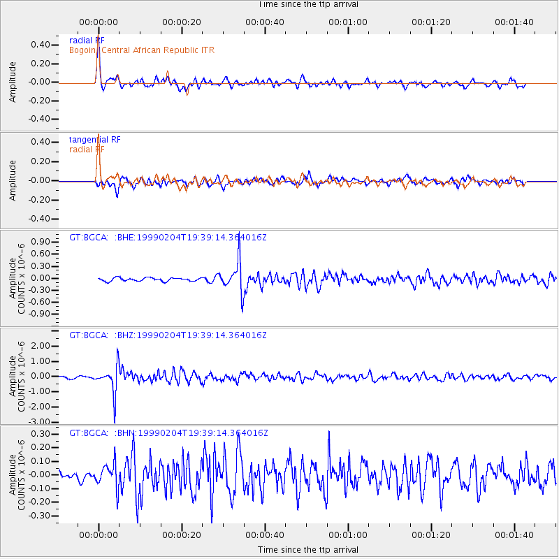
Earthquake location: Northern Sumatra, Indonesia
Earthquake latitude/longitude: 4.0/95.3
Earthquake time(UTC): 1999/02/04 (035) 19:28:00 GMT
Earthquake Depth: 56 km
Earthquake Magnitude: 5.8 MB, 5.4 MS, 5.9 MW, 5.9 MW
Earthquake Catalog/Contributor: WHDF/NEIC
Network: GT Global Telemetered Seismograph Network (USAF/USGS)
Station: BGCA Bogoin, Central African Republic
Lat/Lon: 5.18 N/18.42 E
Elevation: 676 m
Distance: 76.6 deg
Az: 274.339 deg
Baz: 87.097 deg
Ray Param: 0.050794143
Estimated Moho Depth: 42.75 km
Estimated Crust Vp/Vs: 1.68
Assumed Crust Vp: 6.642 km/s
Estimated Crust Vs: 3.953 km/s
Estimated Crust Poisson's Ratio: 0.23
Radial Match: 81.39654 %
Radial Bump: 362
Transverse Match: 69.06838 %
Transverse Bump: 400
SOD ConfigId: 4480
Insert Time: 2010-02-27 01:40:02.346 +0000
GWidth: 2.5
Max Bumps: 400
Tol: 0.001

Signal To Noise

ChannelStoNSTALTA
GT:BGCA: :BHZ:19990204T19:39:14.364016Z12.555659.3345795E-77.434565E-8
GT:BGCA: :BHN:19990204T19:39:14.364016Z1.53438728.9168054E-85.8113134E-8
GT:BGCA: :BHE:19990204T19:39:14.364016Z9.5232173.8955318E-74.090563E-8
Arrivals
Ps4.5 SECOND
PpPs17 SECOND
PsPs/PpSs21 SECOND