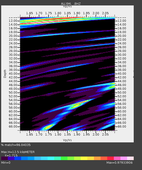
XMI Christmas Island Airport - Earthquake Result Viewer

Earthquake location: Santa Cruz Islands
Earthquake latitude/longitude: -10.8/165.1
Earthquake time(UTC): 2013/02/06 (037) 01:12:25 GMT
Earthquake Depth: 24 km
Earthquake Magnitude: 6.4 MB, 7.4 MS, 8.0 MW, 7.9 MW
Earthquake Catalog/Contributor: WHDF/NEIC
Network: AU Australian Seismological Centre
Station: XMI Christmas Island Airport
Lat/Lon: 10.45 S/105.69 E
Elevation: 252 m
Distance: 58.3 deg
Az: 264.341 deg
Baz: 96.277 deg
Ray Param: 0.06288575
Estimated Moho Depth: 12.5 km
Estimated Crust Vp/Vs: 1.72
Assumed Crust Vp: 4.157 km/s
Estimated Crust Vs: 2.424 km/s
Estimated Crust Poisson's Ratio: 0.24
Radial Match: 96.84035 %
Radial Bump: 269
Transverse Match: 88.37395 %
Transverse Bump: 400
SOD ConfigId: 494114
Insert Time: 2013-05-01 04:21:11.663 +0000
GWidth: 2.5
Max Bumps: 400
Tol: 0.001

Signal To Noise

ChannelStoNSTALTA
AU:XMI: :BHZ:20130206T01:21:47.799971Z3.36740612.3679374E-67.0319334E-7
AU:XMI: :BHN:20130206T01:21:47.799971Z0.61218267.248548E-71.1840499E-6
AU:XMI: :BHE:20130206T01:21:47.799971Z2.49273442.0802588E-68.3452886E-7
Arrivals
Ps2.2 SECOND
PpPs8.0 SECOND
PsPs/PpSs10 SECOND