BFS Mt Baldy Forest Station - Earthquake Result Viewer
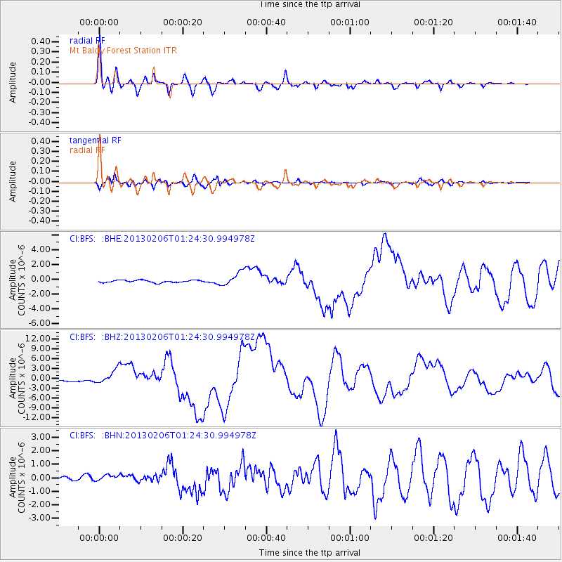
Earthquake location: Santa Cruz Islands
Earthquake latitude/longitude: -10.8/165.1
Earthquake time(UTC): 2013/02/06 (037) 01:12:25 GMT
Earthquake Depth: 24 km
Earthquake Magnitude: 6.4 MB, 7.4 MS, 8.0 MW, 7.9 MW
Earthquake Catalog/Contributor: WHDF/NEIC
Network: CI Caltech Regional Seismic Network
Station: BFS Mt Baldy Forest Station
Lat/Lon: 34.24 N/117.66 W
Elevation: 1312 m
Distance: 85.7 deg
Az: 54.123 deg
Baz: 253.939 deg
Ray Param: 0.044580776
Estimated Moho Depth: 29.25 km
Estimated Crust Vp/Vs: 1.83
Assumed Crust Vp: 6.276 km/s
Estimated Crust Vs: 3.429 km/s
Estimated Crust Poisson's Ratio: 0.29
Radial Match: 95.19134 %
Radial Bump: 400
Transverse Match: 88.61423 %
Transverse Bump: 400
SOD ConfigId: 494114
Insert Time: 2013-05-01 04:27:27.837 +0000
GWidth: 2.5
Max Bumps: 400
Tol: 0.001

Signal To Noise

ChannelStoNSTALTA
CI:BFS: :BHZ:20130206T01:24:30.994978Z5.5619032.250051E-64.0454697E-7
CI:BFS: :BHN:20130206T01:24:30.994978Z0.943494142.3677777E-72.5095838E-7
CI:BFS: :BHE:20130206T01:24:30.994978Z6.05723339.4445085E-71.5592116E-7
Arrivals
Ps4.0 SECOND
PpPs13 SECOND
PsPs/PpSs17 SECOND