NEE2 Needles Airport - Earthquake Result Viewer
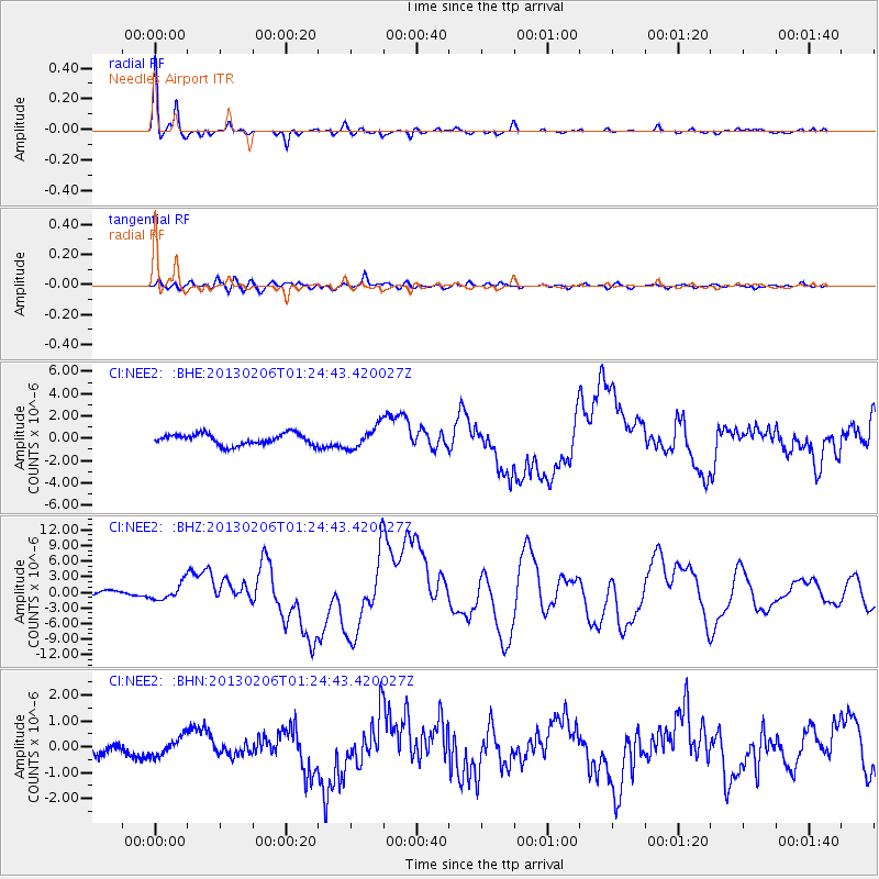
Earthquake location: Santa Cruz Islands
Earthquake latitude/longitude: -10.8/165.1
Earthquake time(UTC): 2013/02/06 (037) 01:12:25 GMT
Earthquake Depth: 24 km
Earthquake Magnitude: 6.4 MB, 7.4 MS, 8.0 MW, 7.9 MW
Earthquake Catalog/Contributor: WHDF/NEIC
Network: CI Caltech Regional Seismic Network
Station: NEE2 Needles Airport
Lat/Lon: 34.77 N/114.62 W
Elevation: 271 m
Distance: 88.2 deg
Az: 54.272 deg
Baz: 255.661 deg
Ray Param: 0.04272403
Estimated Moho Depth: 26.25 km
Estimated Crust Vp/Vs: 1.77
Assumed Crust Vp: 6.276 km/s
Estimated Crust Vs: 3.551 km/s
Estimated Crust Poisson's Ratio: 0.26
Radial Match: 94.29183 %
Radial Bump: 246
Transverse Match: 81.30636 %
Transverse Bump: 400
SOD ConfigId: 494114
Insert Time: 2013-05-01 04:28:15.352 +0000
GWidth: 2.5
Max Bumps: 400
Tol: 0.001

Signal To Noise

ChannelStoNSTALTA
CI:NEE2: :BHZ:20130206T01:24:43.420027Z2.33142691.5690533E-66.730013E-7
CI:NEE2: :BHN:20130206T01:24:43.420027Z1.78635433.529179E-71.9756322E-7
CI:NEE2: :BHE:20130206T01:24:43.420027Z2.01445159.89237E-74.910702E-7
Arrivals
Ps3.3 SECOND
PpPs11 SECOND
PsPs/PpSs15 SECOND