You are here: Home > Network List > TA - USArray Transportable Network (new EarthScope stations) Stations List
> Station 121A Cookes Peak, Deming, NM, USA > Earthquake Result Viewer
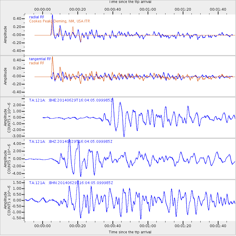
121A Cookes Peak, Deming, NM, USA - Earthquake Result Viewer
*The percent match for this event was below the threshold and hence no stack was calculated.
| Earthquake location: |
Samoa Islands Region |
| Earthquake latitude/longitude: |
-14.8/-175.3 |
| Earthquake time(UTC): |
2014/06/29 (180) 15:52:22 GMT |
| Earthquake Depth: |
10 km |
| Earthquake Magnitude: |
6.4 MWW, 6.4 MWB, 6.5 MWC, 6.8 MI |
| Earthquake Catalog/Contributor: |
NEIC PDE/NEIC COMCAT |
|
| Network: |
TA USArray Transportable Network (new EarthScope stations) |
| Station: |
121A Cookes Peak, Deming, NM, USA |
| Lat/Lon: |
32.53 N/107.79 W |
| Elevation: |
1652 m |
|
| Distance: |
79.8 deg |
| Az: |
52.455 deg |
| Baz: |
245.234 deg |
| Ray Param: |
$rayparam |
*The percent match for this event was below the threshold and hence was not used in the summary stack. |
|
| Radial Match: |
94.39245 % |
| Radial Bump: |
400 |
| Transverse Match: |
84.96935 % |
| Transverse Bump: |
400 |
| SOD ConfigId: |
3390531 |
| Insert Time: |
2019-04-12 14:33:32.821 +0000 |
| GWidth: |
2.5 |
| Max Bumps: |
400 |
| Tol: |
0.001 |
|
Signal To Noise
| Channel | StoN | STA | LTA |
| TA:121A: :BHZ:20140629T16:04:05.099985Z | 1.3068465 | 1.05836584E-7 | 8.098624E-8 |
| TA:121A: :BHN:20140629T16:04:05.099985Z | 1.1294807 | 1.289833E-7 | 1.1419699E-7 |
| TA:121A: :BHE:20140629T16:04:05.099985Z | 1.3860614 | 1.0200641E-7 | 7.3594435E-8 |
| Arrivals |
| Ps | |
| PpPs | |
| PsPs/PpSs | |


