You are here: Home > Network List > US - United States National Seismic Network Stations List
> Station ELK Elko, Nevada, USA > Earthquake Result Viewer
ELK Elko, Nevada, USA - Earthquake Result Viewer
*The percent match for this event was below the threshold and hence no stack was calculated.
| Earthquake location: |
Samoa Islands Region |
| Earthquake latitude/longitude: |
-14.8/-175.3 |
| Earthquake time(UTC): |
2014/06/29 (180) 15:52:22 GMT |
| Earthquake Depth: |
10 km |
| Earthquake Magnitude: |
6.4 MWW, 6.4 MWB, 6.5 MWC, 6.8 MI |
| Earthquake Catalog/Contributor: |
NEIC PDE/NEIC COMCAT |
|
| Network: |
US United States National Seismic Network |
| Station: |
ELK Elko, Nevada, USA |
| Lat/Lon: |
40.74 N/115.24 W |
| Elevation: |
2210 m |
|
| Distance: |
78.3 deg |
| Az: |
42.228 deg |
| Baz: |
238.841 deg |
| Ray Param: |
$rayparam |
*The percent match for this event was below the threshold and hence was not used in the summary stack. |
|
| Radial Match: |
81.271515 % |
| Radial Bump: |
400 |
| Transverse Match: |
79.882225 % |
| Transverse Bump: |
400 |
| SOD ConfigId: |
3390531 |
| Insert Time: |
2019-04-12 14:34:42.671 +0000 |
| GWidth: |
2.5 |
| Max Bumps: |
400 |
| Tol: |
0.001 |
|
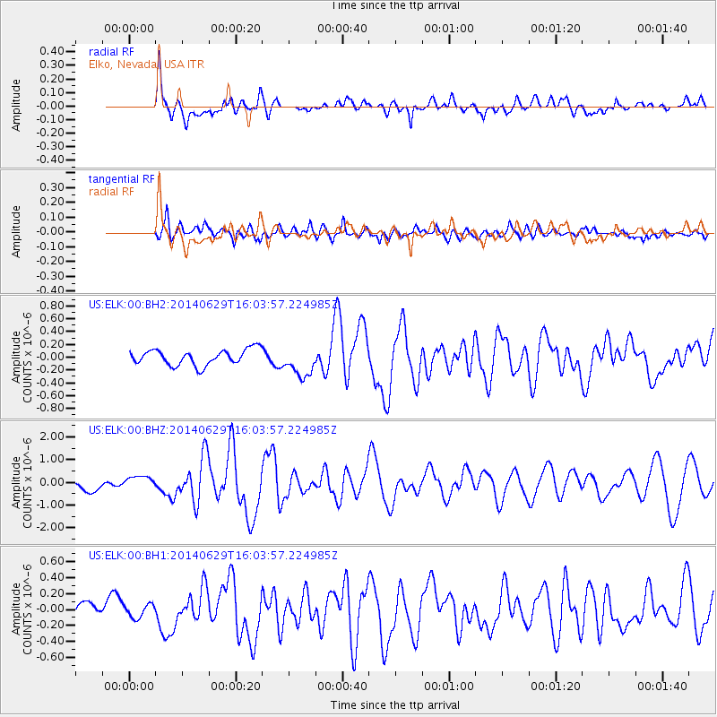
Signal To Noise
| Channel | StoN | STA | LTA |
| US:ELK:00:BHZ:20140629T16:03:57.224985Z | 1.303709 | 2.8293576E-7 | 2.1702371E-7 |
| US:ELK:00:BH1:20140629T16:03:57.224985Z | 0.6003151 | 8.377589E-8 | 1.395532E-7 |
| US:ELK:00:BH2:20140629T16:03:57.224985Z | 1.4620092 | 1.57211E-7 | 1.07530795E-7 |
| Arrivals |
| Ps | |
| PpPs | |
| PsPs/PpSs | |


