You are here: Home > Network List > TA - USArray Transportable Network (new EarthScope stations) Stations List
> Station O03E Paynes Creek, CA, USA > Earthquake Result Viewer
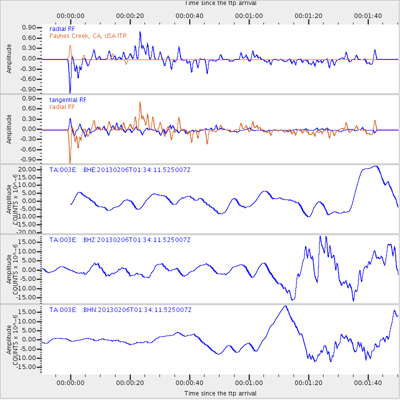
O03E Paynes Creek, CA, USA - Earthquake Result Viewer
*The percent match for this event was below the threshold and hence no stack was calculated.
| Earthquake location: |
Santa Cruz Islands |
| Earthquake latitude/longitude: |
-11.3/165.9 |
| Earthquake time(UTC): |
2013/02/06 (037) 01:22:12 GMT |
| Earthquake Depth: |
13 km |
| Earthquake Magnitude: |
5.6 MB |
| Earthquake Catalog/Contributor: |
WHDF/NEIC |
|
| Network: |
TA USArray Transportable Network (new EarthScope stations) |
| Station: |
O03E Paynes Creek, CA, USA |
| Lat/Lon: |
40.29 N/121.80 W |
| Elevation: |
967 m |
|
| Distance: |
84.1 deg |
| Az: |
47.096 deg |
| Baz: |
249.923 deg |
| Ray Param: |
$rayparam |
*The percent match for this event was below the threshold and hence was not used in the summary stack. |
|
| Radial Match: |
55.075443 % |
| Radial Bump: |
318 |
| Transverse Match: |
48.731026 % |
| Transverse Bump: |
400 |
| SOD ConfigId: |
494114 |
| Insert Time: |
2013-05-01 04:51:43.293 +0000 |
| GWidth: |
2.5 |
| Max Bumps: |
400 |
| Tol: |
0.001 |
|
Signal To Noise
| Channel | StoN | STA | LTA |
| TA:O03E: :BHZ:20130206T01:34:11.525007Z | 0.317895 | 8.145388E-7 | 2.5622887E-6 |
| TA:O03E: :BHN:20130206T01:34:11.525007Z | 0.40225965 | 4.823735E-7 | 1.1991596E-6 |
| TA:O03E: :BHE:20130206T01:34:11.525007Z | 1.2180709 | 3.900997E-6 | 3.2026026E-6 |
| Arrivals |
| Ps | |
| PpPs | |
| PsPs/PpSs | |


