You are here: Home > Network List > AZ - ANZA Regional Network Stations List
> Station SMER AZ.SMER > Earthquake Result Viewer
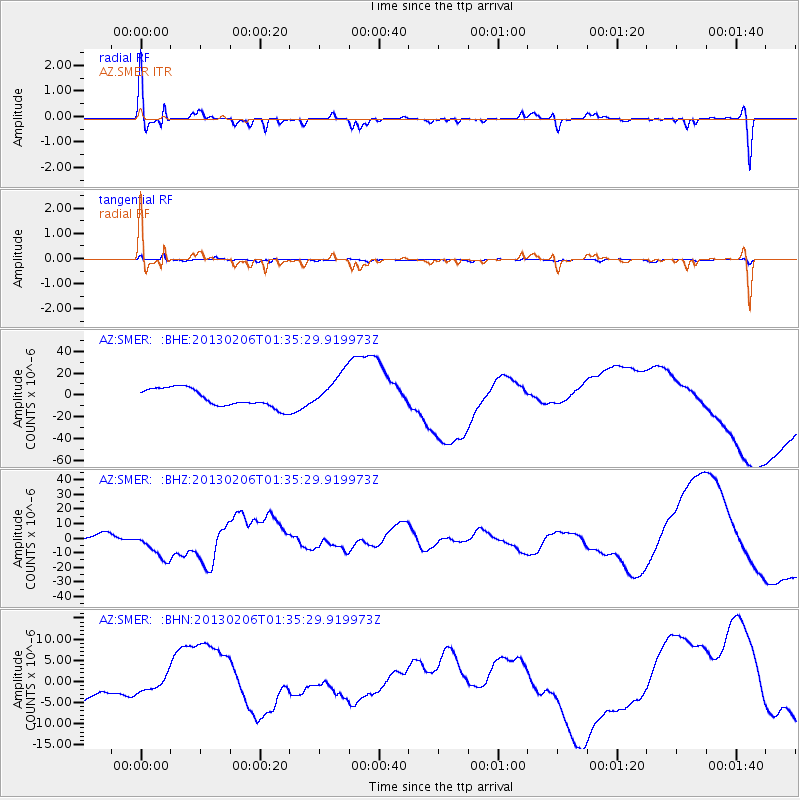
SMER AZ.SMER - Earthquake Result Viewer
*The percent match for this event was below the threshold and hence no stack was calculated.
| Earthquake location: |
Santa Cruz Islands Region |
| Earthquake latitude/longitude: |
-11.2/164.9 |
| Earthquake time(UTC): |
2013/02/06 (037) 01:23:19 GMT |
| Earthquake Depth: |
10 km |
| Earthquake Magnitude: |
6.6 MB, 7.1 MW, 7.1 MW |
| Earthquake Catalog/Contributor: |
WHDF/NEIC |
|
| Network: |
AZ ANZA Regional Network |
| Station: |
SMER AZ.SMER |
| Lat/Lon: |
33.46 N/117.17 W |
| Elevation: |
355 m |
|
| Distance: |
86.2 deg |
| Az: |
55.017 deg |
| Baz: |
254.091 deg |
| Ray Param: |
$rayparam |
*The percent match for this event was below the threshold and hence was not used in the summary stack. |
|
| Radial Match: |
49.261284 % |
| Radial Bump: |
400 |
| Transverse Match: |
54.39869 % |
| Transverse Bump: |
385 |
| SOD ConfigId: |
494114 |
| Insert Time: |
2013-05-01 04:57:12.369 +0000 |
| GWidth: |
2.5 |
| Max Bumps: |
400 |
| Tol: |
0.001 |
|
Signal To Noise
| Channel | StoN | STA | LTA |
| AZ:SMER: :BHZ:20130206T01:35:29.919973Z | 3.3572354 | 1.0939491E-5 | 3.2584821E-6 |
| AZ:SMER: :BHN:20130206T01:35:29.919973Z | 0.6905176 | 1.652595E-6 | 2.3932698E-6 |
| AZ:SMER: :BHE:20130206T01:35:29.919973Z | 2.0261638 | 1.6799833E-5 | 8.291449E-6 |
| Arrivals |
| Ps | |
| PpPs | |
| PsPs/PpSs | |


