You are here: Home > Network List > CI - Caltech Regional Seismic Network Stations List
> Station SWS Sam W. Stewart, Westmorland, CA, USA > Earthquake Result Viewer
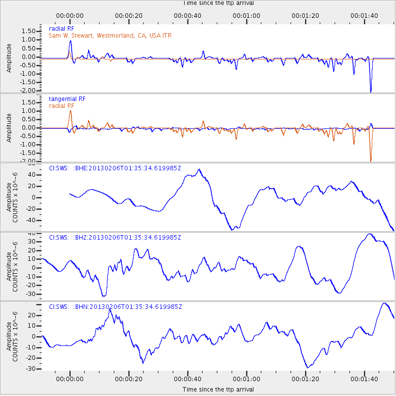
SWS Sam W. Stewart, Westmorland, CA, USA - Earthquake Result Viewer
*The percent match for this event was below the threshold and hence no stack was calculated.
| Earthquake location: |
Santa Cruz Islands Region |
| Earthquake latitude/longitude: |
-11.2/164.9 |
| Earthquake time(UTC): |
2013/02/06 (037) 01:23:19 GMT |
| Earthquake Depth: |
10 km |
| Earthquake Magnitude: |
6.6 MB, 7.1 MW, 7.1 MW |
| Earthquake Catalog/Contributor: |
WHDF/NEIC |
|
| Network: |
CI Caltech Regional Seismic Network |
| Station: |
SWS Sam W. Stewart, Westmorland, CA, USA |
| Lat/Lon: |
32.94 N/115.80 W |
| Elevation: |
140 m |
|
| Distance: |
87.2 deg |
| Az: |
55.823 deg |
| Baz: |
254.886 deg |
| Ray Param: |
$rayparam |
*The percent match for this event was below the threshold and hence was not used in the summary stack. |
|
| Radial Match: |
55.643326 % |
| Radial Bump: |
361 |
| Transverse Match: |
61.69865 % |
| Transverse Bump: |
400 |
| SOD ConfigId: |
494114 |
| Insert Time: |
2013-05-01 04:59:57.298 +0000 |
| GWidth: |
2.5 |
| Max Bumps: |
400 |
| Tol: |
0.001 |
|
Signal To Noise
| Channel | StoN | STA | LTA |
| CI:SWS: :BHZ:20130206T01:35:34.619985Z | 1.3716462 | 6.242701E-6 | 4.5512475E-6 |
| CI:SWS: :BHN:20130206T01:35:34.619985Z | 1.406823 | 5.818505E-6 | 4.135918E-6 |
| CI:SWS: :BHE:20130206T01:35:34.619985Z | 1.8877667 | 1.739217E-5 | 9.213093E-6 |
| Arrivals |
| Ps | |
| PpPs | |
| PsPs/PpSs | |


