You are here: Home > Network List > IW - Intermountain West Stations List
> Station PLID Pearl Lake, Idaho, USA > Earthquake Result Viewer
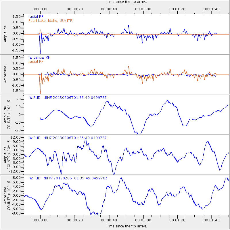
PLID Pearl Lake, Idaho, USA - Earthquake Result Viewer
*The percent match for this event was below the threshold and hence no stack was calculated.
| Earthquake location: |
Santa Cruz Islands Region |
| Earthquake latitude/longitude: |
-11.2/164.9 |
| Earthquake time(UTC): |
2013/02/06 (037) 01:23:19 GMT |
| Earthquake Depth: |
10 km |
| Earthquake Magnitude: |
6.6 MB, 7.1 MW, 7.1 MW |
| Earthquake Catalog/Contributor: |
WHDF/NEIC |
|
| Network: |
IW Intermountain West |
| Station: |
PLID Pearl Lake, Idaho, USA |
| Lat/Lon: |
45.09 N/116.00 W |
| Elevation: |
2164 m |
|
| Distance: |
90.3 deg |
| Az: |
44.081 deg |
| Baz: |
254.499 deg |
| Ray Param: |
$rayparam |
*The percent match for this event was below the threshold and hence was not used in the summary stack. |
|
| Radial Match: |
82.94296 % |
| Radial Bump: |
400 |
| Transverse Match: |
73.66859 % |
| Transverse Bump: |
341 |
| SOD ConfigId: |
494114 |
| Insert Time: |
2013-05-01 05:04:30.487 +0000 |
| GWidth: |
2.5 |
| Max Bumps: |
400 |
| Tol: |
0.001 |
|
Signal To Noise
| Channel | StoN | STA | LTA |
| IW:PLID: :BHZ:20130206T01:35:49.049978Z | 1.2970812 | 3.899032E-6 | 3.0060046E-6 |
| IW:PLID: :BHN:20130206T01:35:49.049978Z | 4.6479707 | 4.3814703E-6 | 9.4266306E-7 |
| IW:PLID: :BHE:20130206T01:35:49.049978Z | 2.3032258 | 9.290309E-6 | 4.0336076E-6 |
| Arrivals |
| Ps | |
| PpPs | |
| PsPs/PpSs | |


