You are here: Home > Network List > TA - USArray Transportable Network (new EarthScope stations) Stations List
> Station MSTX Muleshoe, TX, USA > Earthquake Result Viewer
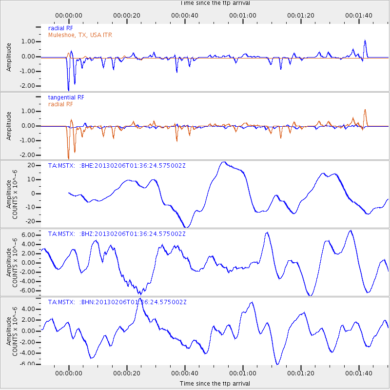
MSTX Muleshoe, TX, USA - Earthquake Result Viewer
*The percent match for this event was below the threshold and hence no stack was calculated.
| Earthquake location: |
Santa Cruz Islands Region |
| Earthquake latitude/longitude: |
-11.2/164.9 |
| Earthquake time(UTC): |
2013/02/06 (037) 01:23:19 GMT |
| Earthquake Depth: |
10 km |
| Earthquake Magnitude: |
6.6 MB, 7.1 MW, 7.1 MW |
| Earthquake Catalog/Contributor: |
WHDF/NEIC |
|
| Network: |
TA USArray Transportable Network (new EarthScope stations) |
| Station: |
MSTX Muleshoe, TX, USA |
| Lat/Lon: |
33.97 N/102.77 W |
| Elevation: |
1167 m |
|
| Distance: |
98.1 deg |
| Az: |
57.003 deg |
| Baz: |
261.999 deg |
| Ray Param: |
$rayparam |
*The percent match for this event was below the threshold and hence was not used in the summary stack. |
|
| Radial Match: |
56.78013 % |
| Radial Bump: |
320 |
| Transverse Match: |
52.444305 % |
| Transverse Bump: |
400 |
| SOD ConfigId: |
494114 |
| Insert Time: |
2013-05-01 05:06:02.636 +0000 |
| GWidth: |
2.5 |
| Max Bumps: |
400 |
| Tol: |
0.001 |
|
Signal To Noise
| Channel | StoN | STA | LTA |
| TA:MSTX: :BHZ:20130206T01:36:24.575002Z | 1.2751266 | 2.3175005E-6 | 1.817467E-6 |
| TA:MSTX: :BHN:20130206T01:36:24.575002Z | 0.8464183 | 9.3749793E-7 | 1.1076058E-6 |
| TA:MSTX: :BHE:20130206T01:36:24.575002Z | 1.4275959 | 7.5328876E-6 | 5.2766245E-6 |
| Arrivals |
| Ps | |
| PpPs | |
| PsPs/PpSs | |


