You are here: Home > Network List > TA - USArray Transportable Network (new EarthScope stations) Stations List
> Station J05D Fort Rock, OR, USA > Earthquake Result Viewer
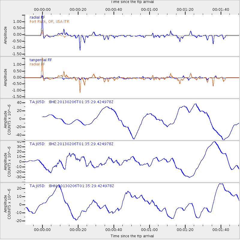
J05D Fort Rock, OR, USA - Earthquake Result Viewer
*The percent match for this event was below the threshold and hence no stack was calculated.
| Earthquake location: |
Santa Cruz Islands Region |
| Earthquake latitude/longitude: |
-11.2/164.9 |
| Earthquake time(UTC): |
2013/02/06 (037) 01:23:19 GMT |
| Earthquake Depth: |
10 km |
| Earthquake Magnitude: |
6.6 MB, 7.1 MW, 7.1 MW |
| Earthquake Catalog/Contributor: |
WHDF/NEIC |
|
| Network: |
TA USArray Transportable Network (new EarthScope stations) |
| Station: |
J05D Fort Rock, OR, USA |
| Lat/Lon: |
43.28 N/121.23 W |
| Elevation: |
1541 m |
|
| Distance: |
86.1 deg |
| Az: |
44.68 deg |
| Baz: |
250.88 deg |
| Ray Param: |
$rayparam |
*The percent match for this event was below the threshold and hence was not used in the summary stack. |
|
| Radial Match: |
61.463142 % |
| Radial Bump: |
360 |
| Transverse Match: |
46.349136 % |
| Transverse Bump: |
384 |
| SOD ConfigId: |
494114 |
| Insert Time: |
2013-05-01 05:06:26.543 +0000 |
| GWidth: |
2.5 |
| Max Bumps: |
400 |
| Tol: |
0.001 |
|
Signal To Noise
| Channel | StoN | STA | LTA |
| TA:J05D: :BHZ:20130206T01:35:29.424978Z | 3.6838362 | 1.43944435E-5 | 3.9074603E-6 |
| TA:J05D: :BHN:20130206T01:35:29.424978Z | 1.4072367 | 7.755884E-6 | 5.5114283E-6 |
| TA:J05D: :BHE:20130206T01:35:29.424978Z | 2.281065 | 1.8298615E-5 | 8.021962E-6 |
| Arrivals |
| Ps | |
| PpPs | |
| PsPs/PpSs | |


