You are here: Home > Network List > US - United States National Seismic Network Stations List
> Station BW06 Boulder Array Site 6 (Pinedale), Wyoming, USA > Earthquake Result Viewer
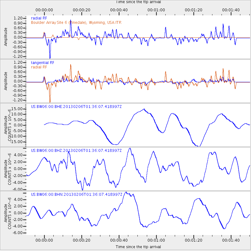
BW06 Boulder Array Site 6 (Pinedale), Wyoming, USA - Earthquake Result Viewer
*The percent match for this event was below the threshold and hence no stack was calculated.
| Earthquake location: |
Santa Cruz Islands Region |
| Earthquake latitude/longitude: |
-11.2/164.9 |
| Earthquake time(UTC): |
2013/02/06 (037) 01:23:19 GMT |
| Earthquake Depth: |
10 km |
| Earthquake Magnitude: |
6.6 MB, 7.1 MW, 7.1 MW |
| Earthquake Catalog/Contributor: |
WHDF/NEIC |
|
| Network: |
US United States National Seismic Network |
| Station: |
BW06 Boulder Array Site 6 (Pinedale), Wyoming, USA |
| Lat/Lon: |
42.77 N/109.56 W |
| Elevation: |
2224 m |
|
| Distance: |
94.3 deg |
| Az: |
47.411 deg |
| Baz: |
258.823 deg |
| Ray Param: |
$rayparam |
*The percent match for this event was below the threshold and hence was not used in the summary stack. |
|
| Radial Match: |
61.096252 % |
| Radial Bump: |
400 |
| Transverse Match: |
55.640553 % |
| Transverse Bump: |
335 |
| SOD ConfigId: |
494114 |
| Insert Time: |
2013-05-01 05:08:35.924 +0000 |
| GWidth: |
2.5 |
| Max Bumps: |
400 |
| Tol: |
0.001 |
|
Signal To Noise
| Channel | StoN | STA | LTA |
| US:BW06:00:BHZ:20130206T01:36:07.418997Z | 1.2983601 | 2.9274827E-6 | 2.254754E-6 |
| US:BW06:00:BHN:20130206T01:36:07.418997Z | 0.90142864 | 7.05291E-7 | 7.8241465E-7 |
| US:BW06:00:BHE:20130206T01:36:07.418997Z | 8.514351 | 9.90858E-6 | 1.1637504E-6 |
| Arrivals |
| Ps | |
| PpPs | |
| PsPs/PpSs | |


