You are here: Home > Network List > G - GEOSCOPE Stations List
> Station INU Inuyama, Japan > Earthquake Result Viewer
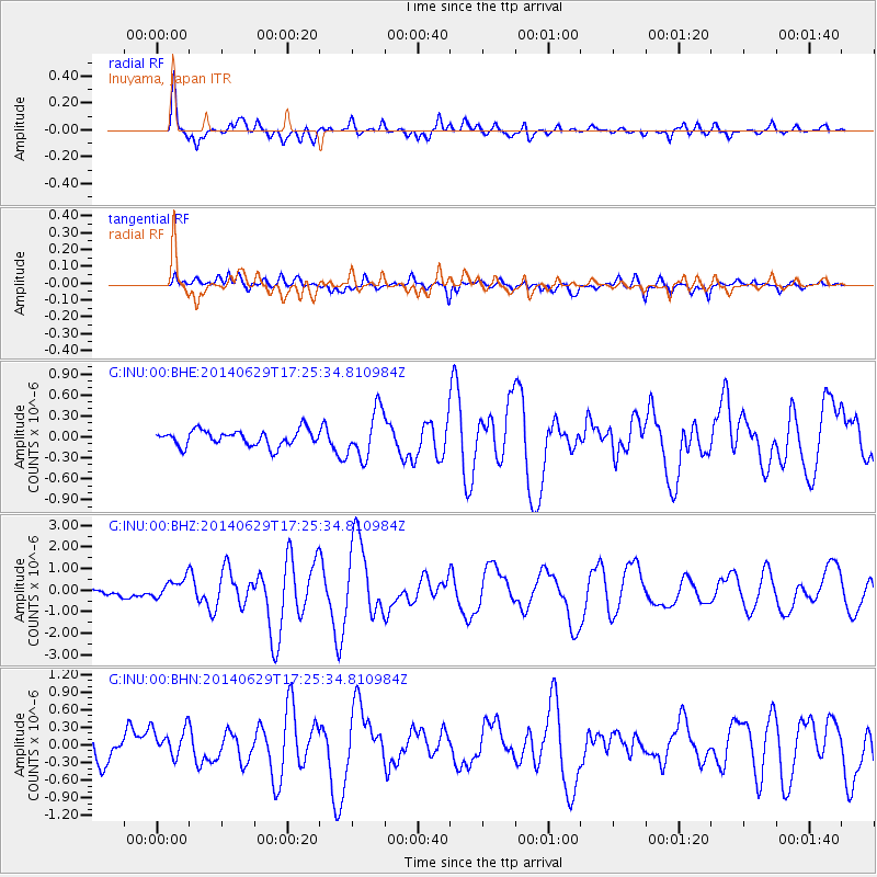
INU Inuyama, Japan - Earthquake Result Viewer
*The percent match for this event was below the threshold and hence no stack was calculated.
| Earthquake location: |
Tonga Islands |
| Earthquake latitude/longitude: |
-15.0/-175.6 |
| Earthquake time(UTC): |
2014/06/29 (180) 17:15:08 GMT |
| Earthquake Depth: |
10 km |
| Earthquake Magnitude: |
6.7 MWW, 6.7 MWC, 6.8 MI |
| Earthquake Catalog/Contributor: |
NEIC PDE/NEIC COMCAT |
|
| Network: |
G GEOSCOPE |
| Station: |
INU Inuyama, Japan |
| Lat/Lon: |
35.35 N/137.03 E |
| Elevation: |
132 m |
|
| Distance: |
67.3 deg |
| Az: |
319.283 deg |
| Baz: |
129.557 deg |
| Ray Param: |
$rayparam |
*The percent match for this event was below the threshold and hence was not used in the summary stack. |
|
| Radial Match: |
89.85066 % |
| Radial Bump: |
376 |
| Transverse Match: |
75.04569 % |
| Transverse Bump: |
400 |
| SOD ConfigId: |
3390531 |
| Insert Time: |
2019-04-12 14:39:01.254 +0000 |
| GWidth: |
2.5 |
| Max Bumps: |
400 |
| Tol: |
0.001 |
|
Signal To Noise
| Channel | StoN | STA | LTA |
| G:INU:00:BHZ:20140629T17:25:34.810984Z | 1.7830272 | 4.524218E-7 | 2.5373802E-7 |
| G:INU:00:BHN:20140629T17:25:34.810984Z | 1.4065527 | 2.6679794E-7 | 1.8968214E-7 |
| G:INU:00:BHE:20140629T17:25:34.810984Z | 2.22844 | 2.3416659E-7 | 1.0508095E-7 |
| Arrivals |
| Ps | |
| PpPs | |
| PsPs/PpSs | |


