You are here: Home > Network List > UW - Pacific Northwest Regional Seismic Network Stations List
> Station LON Longmire (broad-band and DWWSSN) > Earthquake Result Viewer
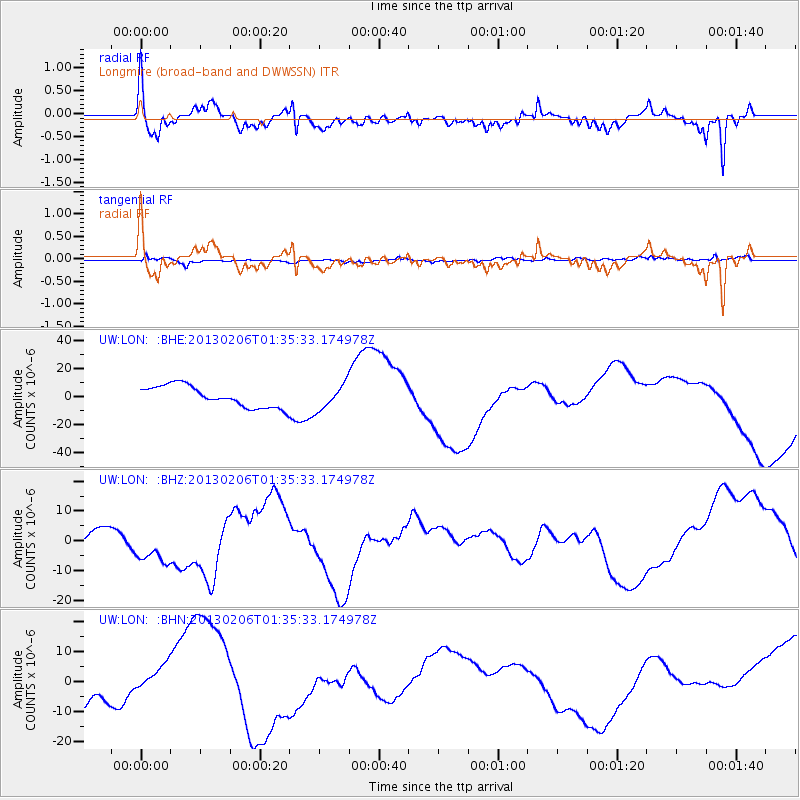
LON Longmire (broad-band and DWWSSN) - Earthquake Result Viewer
*The percent match for this event was below the threshold and hence no stack was calculated.
| Earthquake location: |
Santa Cruz Islands Region |
| Earthquake latitude/longitude: |
-11.2/164.9 |
| Earthquake time(UTC): |
2013/02/06 (037) 01:23:19 GMT |
| Earthquake Depth: |
10 km |
| Earthquake Magnitude: |
6.6 MB, 7.1 MW, 7.1 MW |
| Earthquake Catalog/Contributor: |
WHDF/NEIC |
|
| Network: |
UW Pacific Northwest Regional Seismic Network |
| Station: |
LON Longmire (broad-band and DWWSSN) |
| Lat/Lon: |
46.75 N/121.81 W |
| Elevation: |
850 m |
|
| Distance: |
86.9 deg |
| Az: |
41.27 deg |
| Baz: |
250.268 deg |
| Ray Param: |
$rayparam |
*The percent match for this event was below the threshold and hence was not used in the summary stack. |
|
| Radial Match: |
57.43156 % |
| Radial Bump: |
400 |
| Transverse Match: |
59.016926 % |
| Transverse Bump: |
382 |
| SOD ConfigId: |
494114 |
| Insert Time: |
2013-05-01 05:08:48.043 +0000 |
| GWidth: |
2.5 |
| Max Bumps: |
400 |
| Tol: |
0.001 |
|
Signal To Noise
| Channel | StoN | STA | LTA |
| UW:LON: :BHZ:20130206T01:35:33.174978Z | 3.4024725 | 7.013868E-6 | 2.0614034E-6 |
| UW:LON: :BHN:20130206T01:35:33.174978Z | 0.983105 | 5.109248E-6 | 5.197052E-6 |
| UW:LON: :BHE:20130206T01:35:33.174978Z | 1.1734748 | 8.921841E-6 | 7.6029255E-6 |
| Arrivals |
| Ps | |
| PpPs | |
| PsPs/PpSs | |


