You are here: Home > Network List > GS - US Geological Survey Networks Stations List
> Station DEC12 Boyd Road Surface Site > Earthquake Result Viewer
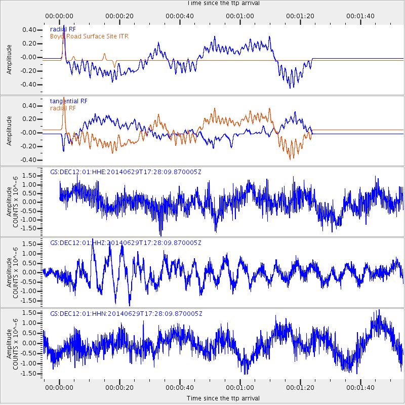
DEC12 Boyd Road Surface Site - Earthquake Result Viewer
*The percent match for this event was below the threshold and hence no stack was calculated.
| Earthquake location: |
Tonga Islands |
| Earthquake latitude/longitude: |
-15.0/-175.6 |
| Earthquake time(UTC): |
2014/06/29 (180) 17:15:08 GMT |
| Earthquake Depth: |
10 km |
| Earthquake Magnitude: |
6.7 MWW, 6.7 MWC, 6.8 MI |
| Earthquake Catalog/Contributor: |
NEIC PDE/NEIC COMCAT |
|
| Network: |
GS US Geological Survey Networks |
| Station: |
DEC12 Boyd Road Surface Site |
| Lat/Lon: |
39.91 N/88.91 W |
| Elevation: |
208 m |
|
| Distance: |
97.0 deg |
| Az: |
50.681 deg |
| Baz: |
256.343 deg |
| Ray Param: |
$rayparam |
*The percent match for this event was below the threshold and hence was not used in the summary stack. |
|
| Radial Match: |
57.613358 % |
| Radial Bump: |
400 |
| Transverse Match: |
39.71698 % |
| Transverse Bump: |
400 |
| SOD ConfigId: |
3390531 |
| Insert Time: |
2019-04-12 14:39:07.983 +0000 |
| GWidth: |
2.5 |
| Max Bumps: |
400 |
| Tol: |
0.001 |
|
Signal To Noise
| Channel | StoN | STA | LTA |
| GS:DEC12:01:HHZ:20140629T17:28:09.870005Z | 1.5263661 | 4.0883822E-7 | 2.6785068E-7 |
| GS:DEC12:01:HHN:20140629T17:28:09.870005Z | 1.3022162 | 5.9881035E-7 | 4.5983944E-7 |
| GS:DEC12:01:HHE:20140629T17:28:09.870005Z | 1.3659788 | 6.460708E-7 | 4.7297277E-7 |
| Arrivals |
| Ps | |
| PpPs | |
| PsPs/PpSs | |


