You are here: Home > Network List > UW - Pacific Northwest Regional Seismic Network Stations List
> Station UMAT Pilot Rock, OR, USA > Earthquake Result Viewer
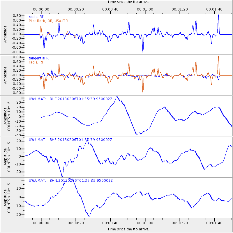
UMAT Pilot Rock, OR, USA - Earthquake Result Viewer
*The percent match for this event was below the threshold and hence no stack was calculated.
| Earthquake location: |
Santa Cruz Islands Region |
| Earthquake latitude/longitude: |
-11.2/164.9 |
| Earthquake time(UTC): |
2013/02/06 (037) 01:23:19 GMT |
| Earthquake Depth: |
10 km |
| Earthquake Magnitude: |
6.6 MB, 7.1 MW, 7.1 MW |
| Earthquake Catalog/Contributor: |
WHDF/NEIC |
|
| Network: |
UW Pacific Northwest Regional Seismic Network |
| Station: |
UMAT Pilot Rock, OR, USA |
| Lat/Lon: |
45.29 N/118.96 W |
| Elevation: |
1318 m |
|
| Distance: |
88.3 deg |
| Az: |
43.29 deg |
| Baz: |
252.396 deg |
| Ray Param: |
$rayparam |
*The percent match for this event was below the threshold and hence was not used in the summary stack. |
|
| Radial Match: |
36.8295 % |
| Radial Bump: |
231 |
| Transverse Match: |
60.072582 % |
| Transverse Bump: |
354 |
| SOD ConfigId: |
494114 |
| Insert Time: |
2013-05-01 05:09:29.969 +0000 |
| GWidth: |
2.5 |
| Max Bumps: |
400 |
| Tol: |
0.001 |
|
Signal To Noise
| Channel | StoN | STA | LTA |
| UW:UMAT: :BHZ:20130206T01:35:39.950002Z | 1.7976623 | 3.595869E-6 | 2.0003029E-6 |
| UW:UMAT: :BHN:20130206T01:35:39.950002Z | 1.9885496 | 7.75119E-6 | 3.8979115E-6 |
| UW:UMAT: :BHE:20130206T01:35:39.950002Z | 1.9577019 | 1.3206289E-5 | 6.7458122E-6 |
| Arrivals |
| Ps | |
| PpPs | |
| PsPs/PpSs | |


