BGCA Bogoin, Central African Republic - Earthquake Result Viewer
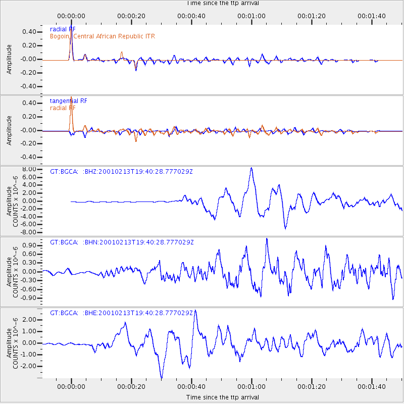
Earthquake location: Southern Sumatra, Indonesia
Earthquake latitude/longitude: -4.7/102.6
Earthquake time(UTC): 2001/02/13 (044) 19:28:30 GMT
Earthquake Depth: 36 km
Earthquake Magnitude: 6.2 MB, 7.2 MS, 7.4 MW, 7.0 ME
Earthquake Catalog/Contributor: WHDF/NEIC
Network: GT Global Telemetered Seismograph Network (USAF/USGS)
Station: BGCA Bogoin, Central African Republic
Lat/Lon: 5.18 N/18.42 E
Elevation: 676 m
Distance: 84.6 deg
Az: 275.624 deg
Baz: 95.178 deg
Ray Param: 0.04531706
Estimated Moho Depth: 43.25 km
Estimated Crust Vp/Vs: 1.69
Assumed Crust Vp: 6.642 km/s
Estimated Crust Vs: 3.93 km/s
Estimated Crust Poisson's Ratio: 0.23
Radial Match: 97.393906 %
Radial Bump: 361
Transverse Match: 92.01146 %
Transverse Bump: 400
SOD ConfigId: 3744
Insert Time: 2010-02-27 01:41:32.149 +0000
GWidth: 2.5
Max Bumps: 400
Tol: 0.001

Signal To Noise

ChannelStoNSTALTA
GT:BGCA: :BHN:20010213T19:40:28.777029Z0.92277824.567424E-84.9496446E-8
GT:BGCA: :BHE:20010213T19:40:28.777029Z1.01179475.794785E-85.727234E-8
GT:BGCA: :BHZ:20010213T19:40:28.777029Z2.53007461.5628528E-76.177102E-8
Arrivals
Ps4.6 SECOND
PpPs17 SECOND
PsPs/PpSs22 SECOND