You are here: Home > Network List > TA - USArray Transportable Network (new EarthScope stations) Stations List
> Station O03E Paynes Creek, CA, USA > Earthquake Result Viewer
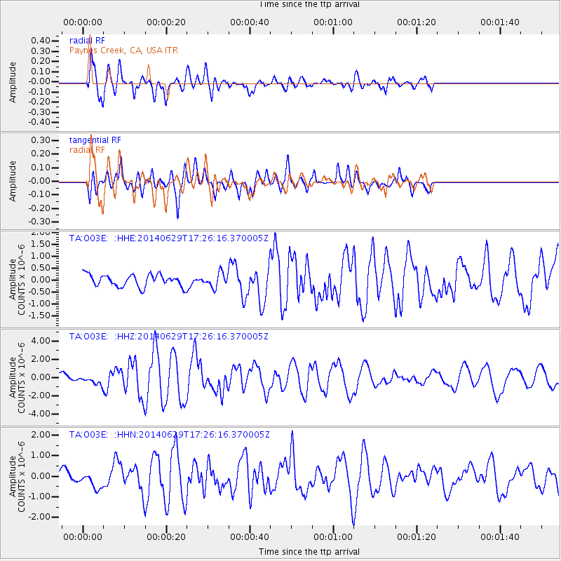
O03E Paynes Creek, CA, USA - Earthquake Result Viewer
*The percent match for this event was below the threshold and hence no stack was calculated.
| Earthquake location: |
Tonga Islands |
| Earthquake latitude/longitude: |
-15.0/-175.6 |
| Earthquake time(UTC): |
2014/06/29 (180) 17:15:08 GMT |
| Earthquake Depth: |
10 km |
| Earthquake Magnitude: |
6.7 MWW, 6.7 MWC, 6.8 MI |
| Earthquake Catalog/Contributor: |
NEIC PDE/NEIC COMCAT |
|
| Network: |
TA USArray Transportable Network (new EarthScope stations) |
| Station: |
O03E Paynes Creek, CA, USA |
| Lat/Lon: |
40.29 N/121.80 W |
| Elevation: |
967 m |
|
| Distance: |
74.3 deg |
| Az: |
39.856 deg |
| Baz: |
234.049 deg |
| Ray Param: |
$rayparam |
*The percent match for this event was below the threshold and hence was not used in the summary stack. |
|
| Radial Match: |
79.27101 % |
| Radial Bump: |
400 |
| Transverse Match: |
81.60884 % |
| Transverse Bump: |
400 |
| SOD ConfigId: |
3390531 |
| Insert Time: |
2019-04-12 14:41:04.974 +0000 |
| GWidth: |
2.5 |
| Max Bumps: |
400 |
| Tol: |
0.001 |
|
Signal To Noise
| Channel | StoN | STA | LTA |
| TA:O03E: :HHZ:20140629T17:26:16.370005Z | 1.6440976 | 4.6427238E-7 | 2.8238736E-7 |
| TA:O03E: :HHN:20140629T17:26:16.370005Z | 0.82787806 | 3.8542427E-7 | 4.655568E-7 |
| TA:O03E: :HHE:20140629T17:26:16.370005Z | 1.1096988 | 2.6164156E-7 | 2.357771E-7 |
| Arrivals |
| Ps | |
| PpPs | |
| PsPs/PpSs | |


