You are here: Home > Network List > AV - Alaska Volcano Observatory Stations List
> Station SPCR Ckakachatna River, Mount Spurr, Alaska > Earthquake Result Viewer
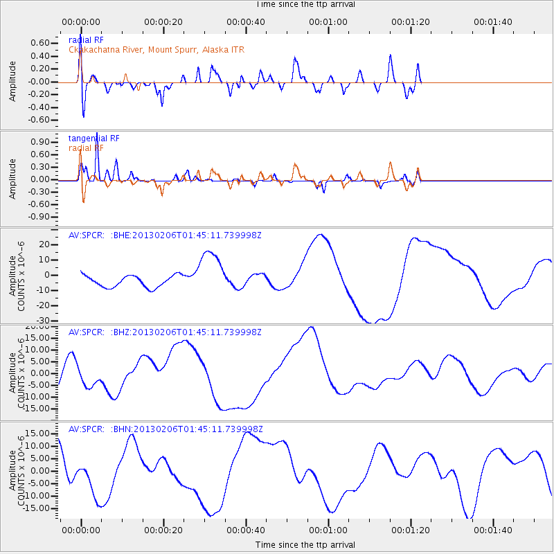
SPCR Ckakachatna River, Mount Spurr, Alaska - Earthquake Result Viewer
*The percent match for this event was below the threshold and hence no stack was calculated.
| Earthquake location: |
Santa Cruz Islands |
| Earthquake latitude/longitude: |
-11.0/165.2 |
| Earthquake time(UTC): |
2013/02/06 (037) 01:33:37 GMT |
| Earthquake Depth: |
10 km |
| Earthquake Magnitude: |
5.6 MB |
| Earthquake Catalog/Contributor: |
WHDF/NEIC |
|
| Network: |
AV Alaska Volcano Observatory |
| Station: |
SPCR Ckakachatna River, Mount Spurr, Alaska |
| Lat/Lon: |
61.20 N/152.21 W |
| Elevation: |
984 m |
|
| Distance: |
79.4 deg |
| Az: |
19.474 deg |
| Baz: |
222.536 deg |
| Ray Param: |
$rayparam |
*The percent match for this event was below the threshold and hence was not used in the summary stack. |
|
| Radial Match: |
73.50868 % |
| Radial Bump: |
359 |
| Transverse Match: |
79.72057 % |
| Transverse Bump: |
213 |
| SOD ConfigId: |
494114 |
| Insert Time: |
2013-05-01 05:26:16.933 +0000 |
| GWidth: |
2.5 |
| Max Bumps: |
400 |
| Tol: |
0.001 |
|
Signal To Noise
| Channel | StoN | STA | LTA |
| AV:SPCR: :BHZ:20130206T01:45:11.739998Z | 0.8498809 | 3.943014E-6 | 4.63949E-6 |
| AV:SPCR: :BHN:20130206T01:45:11.739998Z | 1.3767471 | 8.541043E-6 | 6.203785E-6 |
| AV:SPCR: :BHE:20130206T01:45:11.739998Z | 4.259686 | 1.6073664E-5 | 3.7734385E-6 |
| Arrivals |
| Ps | |
| PpPs | |
| PsPs/PpSs | |


