You are here: Home > Network List > US - United States National Seismic Network Stations List
> Station HAWA Hanford, Washington, USA > Earthquake Result Viewer
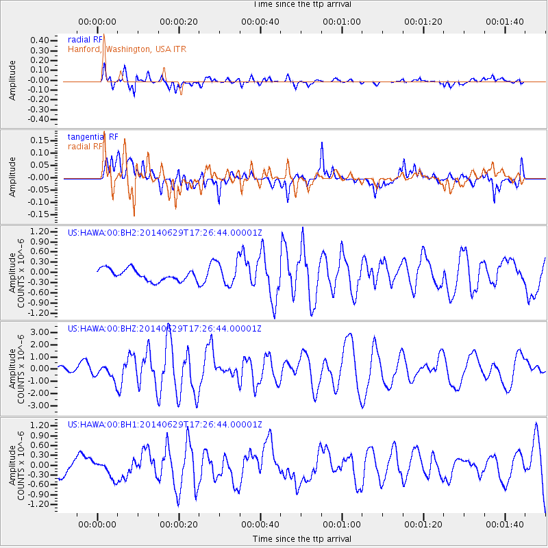
HAWA Hanford, Washington, USA - Earthquake Result Viewer
*The percent match for this event was below the threshold and hence no stack was calculated.
| Earthquake location: |
Tonga Islands |
| Earthquake latitude/longitude: |
-15.0/-175.6 |
| Earthquake time(UTC): |
2014/06/29 (180) 17:15:08 GMT |
| Earthquake Depth: |
10 km |
| Earthquake Magnitude: |
6.7 MWW, 6.7 MWC, 6.8 MI |
| Earthquake Catalog/Contributor: |
NEIC PDE/NEIC COMCAT |
|
| Network: |
US United States National Seismic Network |
| Station: |
HAWA Hanford, Washington, USA |
| Lat/Lon: |
46.39 N/119.53 W |
| Elevation: |
364 m |
|
| Distance: |
79.2 deg |
| Az: |
35.761 deg |
| Baz: |
234.664 deg |
| Ray Param: |
$rayparam |
*The percent match for this event was below the threshold and hence was not used in the summary stack. |
|
| Radial Match: |
82.30978 % |
| Radial Bump: |
400 |
| Transverse Match: |
55.263096 % |
| Transverse Bump: |
400 |
| SOD ConfigId: |
3390531 |
| Insert Time: |
2019-04-12 14:41:41.503 +0000 |
| GWidth: |
2.5 |
| Max Bumps: |
400 |
| Tol: |
0.001 |
|
Signal To Noise
| Channel | StoN | STA | LTA |
| US:HAWA:00:BHZ:20140629T17:26:44.00001Z | 2.1107306 | 6.135506E-7 | 2.906816E-7 |
| US:HAWA:00:BH1:20140629T17:26:44.00001Z | 0.7462846 | 2.5924084E-7 | 3.473753E-7 |
| US:HAWA:00:BH2:20140629T17:26:44.00001Z | 2.0246394 | 3.429649E-7 | 1.6939555E-7 |
| Arrivals |
| Ps | |
| PpPs | |
| PsPs/PpSs | |


