You are here: Home > Network List > CI - Caltech Regional Seismic Network Stations List
> Station SWS Sam W. Stewart, Westmorland, CA, USA > Earthquake Result Viewer
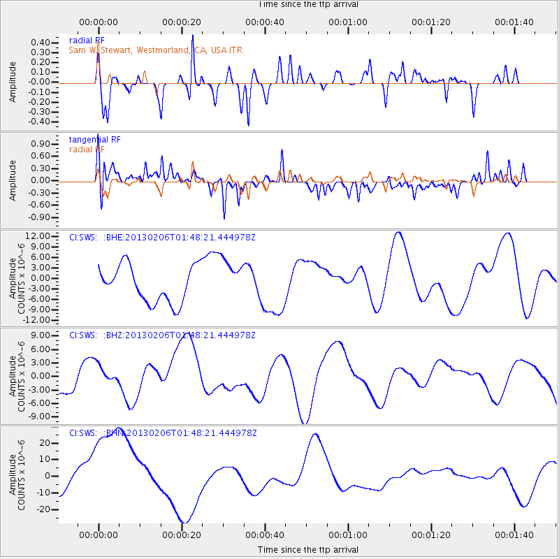
SWS Sam W. Stewart, Westmorland, CA, USA - Earthquake Result Viewer
*The percent match for this event was below the threshold and hence no stack was calculated.
| Earthquake location: |
Santa Cruz Islands |
| Earthquake latitude/longitude: |
-11.8/165.3 |
| Earthquake time(UTC): |
2013/02/06 (037) 01:36:06 GMT |
| Earthquake Depth: |
10 km |
| Earthquake Magnitude: |
5.5 MB |
| Earthquake Catalog/Contributor: |
WHDF/NEIC |
|
| Network: |
CI Caltech Regional Seismic Network |
| Station: |
SWS Sam W. Stewart, Westmorland, CA, USA |
| Lat/Lon: |
32.94 N/115.80 W |
| Elevation: |
140 m |
|
| Distance: |
87.2 deg |
| Az: |
55.704 deg |
| Baz: |
254.14 deg |
| Ray Param: |
$rayparam |
*The percent match for this event was below the threshold and hence was not used in the summary stack. |
|
| Radial Match: |
28.911285 % |
| Radial Bump: |
300 |
| Transverse Match: |
46.54442 % |
| Transverse Bump: |
347 |
| SOD ConfigId: |
494114 |
| Insert Time: |
2013-05-01 05:36:41.645 +0000 |
| GWidth: |
2.5 |
| Max Bumps: |
400 |
| Tol: |
0.001 |
|
Signal To Noise
| Channel | StoN | STA | LTA |
| CI:SWS: :BHZ:20130206T01:48:21.444978Z | 0.9300327 | 2.9431746E-6 | 3.1645927E-6 |
| CI:SWS: :BHN:20130206T01:48:21.444978Z | 8.391419 | 3.346921E-5 | 3.9885035E-6 |
| CI:SWS: :BHE:20130206T01:48:21.444978Z | 1.1890728 | 6.145385E-6 | 5.168216E-6 |
| Arrivals |
| Ps | |
| PpPs | |
| PsPs/PpSs | |


