You are here: Home > Network List > CI - Caltech Regional Seismic Network Stations List
> Station MPM Manuel Prospect Mine, California, USA > Earthquake Result Viewer
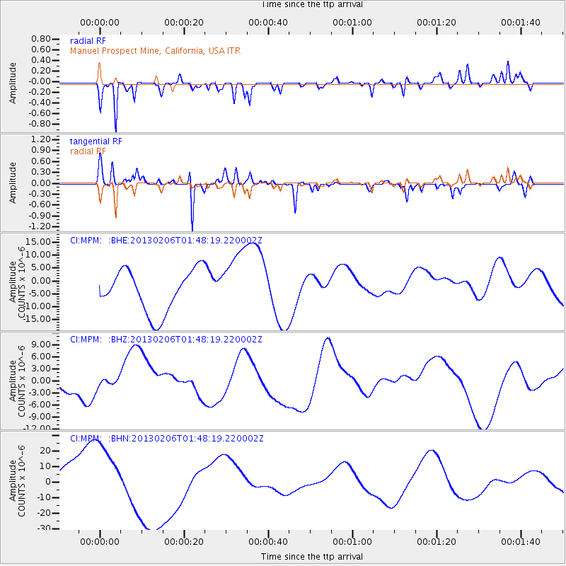
MPM Manuel Prospect Mine, California, USA - Earthquake Result Viewer
*The percent match for this event was below the threshold and hence no stack was calculated.
| Earthquake location: |
Santa Cruz Islands |
| Earthquake latitude/longitude: |
-11.8/165.3 |
| Earthquake time(UTC): |
2013/02/06 (037) 01:36:06 GMT |
| Earthquake Depth: |
10 km |
| Earthquake Magnitude: |
5.5 MB |
| Earthquake Catalog/Contributor: |
WHDF/NEIC |
|
| Network: |
CI Caltech Regional Seismic Network |
| Station: |
MPM Manuel Prospect Mine, California, USA |
| Lat/Lon: |
36.06 N/117.49 W |
| Elevation: |
185 m |
|
| Distance: |
86.8 deg |
| Az: |
52.322 deg |
| Baz: |
253.007 deg |
| Ray Param: |
$rayparam |
*The percent match for this event was below the threshold and hence was not used in the summary stack. |
|
| Radial Match: |
45.205627 % |
| Radial Bump: |
231 |
| Transverse Match: |
56.270676 % |
| Transverse Bump: |
190 |
| SOD ConfigId: |
494114 |
| Insert Time: |
2013-05-01 05:36:45.973 +0000 |
| GWidth: |
2.5 |
| Max Bumps: |
400 |
| Tol: |
0.001 |
|
Signal To Noise
| Channel | StoN | STA | LTA |
| CI:MPM: :BHZ:20130206T01:48:19.220002Z | 0.55735826 | 1.2505891E-6 | 2.2437796E-6 |
| CI:MPM: :BHN:20130206T01:48:19.220002Z | 2.1945953 | 2.0796402E-5 | 9.47619E-6 |
| CI:MPM: :BHE:20130206T01:48:19.220002Z | 1.5684271 | 1.2720764E-5 | 8.110524E-6 |
| Arrivals |
| Ps | |
| PpPs | |
| PsPs/PpSs | |


