You are here: Home > Network List > UW - Pacific Northwest Regional Seismic Network Stations List
> Station MRBL Marblemount, WA, USA > Earthquake Result Viewer
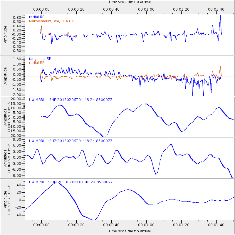
MRBL Marblemount, WA, USA - Earthquake Result Viewer
*The percent match for this event was below the threshold and hence no stack was calculated.
| Earthquake location: |
Santa Cruz Islands |
| Earthquake latitude/longitude: |
-11.8/165.3 |
| Earthquake time(UTC): |
2013/02/06 (037) 01:36:06 GMT |
| Earthquake Depth: |
10 km |
| Earthquake Magnitude: |
5.5 MB |
| Earthquake Catalog/Contributor: |
WHDF/NEIC |
|
| Network: |
UW Pacific Northwest Regional Seismic Network |
| Station: |
MRBL Marblemount, WA, USA |
| Lat/Lon: |
48.52 N/121.48 W |
| Elevation: |
75 m |
|
| Distance: |
87.9 deg |
| Az: |
39.566 deg |
| Baz: |
249.719 deg |
| Ray Param: |
$rayparam |
*The percent match for this event was below the threshold and hence was not used in the summary stack. |
|
| Radial Match: |
54.020157 % |
| Radial Bump: |
398 |
| Transverse Match: |
38.159718 % |
| Transverse Bump: |
295 |
| SOD ConfigId: |
494114 |
| Insert Time: |
2013-05-01 05:43:00.602 +0000 |
| GWidth: |
2.5 |
| Max Bumps: |
400 |
| Tol: |
0.001 |
|
Signal To Noise
| Channel | StoN | STA | LTA |
| UW:MRBL: :BHZ:20130206T01:48:24.850007Z | 0.4357971 | 1.5059708E-6 | 3.4556695E-6 |
| UW:MRBL: :BHN:20130206T01:48:24.850007Z | 3.6809015 | 3.651039E-5 | 9.918872E-6 |
| UW:MRBL: :BHE:20130206T01:48:24.850007Z | 4.23258 | 2.0357607E-5 | 4.8097395E-6 |
| Arrivals |
| Ps | |
| PpPs | |
| PsPs/PpSs | |


