You are here: Home > Network List > CI - Caltech Regional Seismic Network Stations List
> Station GLA Glamis, Glamis, CA, USA > Earthquake Result Viewer
GLA Glamis, Glamis, CA, USA - Earthquake Result Viewer

| Earthquake location: |
Santa Cruz Islands |
| Earthquake latitude/longitude: |
-11.5/165.5 |
| Earthquake time(UTC): |
2013/02/06 (037) 01:57:26 GMT |
| Earthquake Depth: |
10 km |
| Earthquake Magnitude: |
5.6 MB |
| Earthquake Catalog/Contributor: |
WHDF/NEIC |
|
| Network: |
CI Caltech Regional Seismic Network |
| Station: |
GLA Glamis, Glamis, CA, USA |
| Lat/Lon: |
33.05 N/114.83 W |
| Elevation: |
610 m |
|
| Distance: |
87.7 deg |
| Az: |
55.781 deg |
| Baz: |
254.822 deg |
| Ray Param: |
0.04314475 |
| Estimated Moho Depth: |
51.75 km |
| Estimated Crust Vp/Vs: |
1.64 |
| Assumed Crust Vp: |
6.155 km/s |
| Estimated Crust Vs: |
3.753 km/s |
| Estimated Crust Poisson's Ratio: |
0.20 |
|
| Radial Match: |
94.71213 % |
| Radial Bump: |
400 |
| Transverse Match: |
92.074615 % |
| Transverse Bump: |
389 |
| SOD ConfigId: |
494114 |
| Insert Time: |
2013-05-01 06:01:10.414 +0000 |
| GWidth: |
2.5 |
| Max Bumps: |
400 |
| Tol: |
0.001 |
|
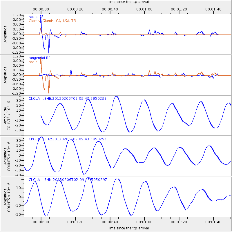
Signal To Noise
| Channel | StoN | STA | LTA |
| CI:GLA: :BHZ:20130206T02:09:43.595029Z | 1.9119587 | 3.0550887E-5 | 1.5978841E-5 |
| CI:GLA: :BHN:20130206T02:09:43.595029Z | 1.7144282 | 1.4554045E-5 | 8.489154E-6 |
| CI:GLA: :BHE:20130206T02:09:43.595029Z | 1.0809649 | 1.7672162E-5 | 1.6348506E-5 |
| Arrivals |
| Ps | 5.5 SECOND |
| PpPs | 22 SECOND |
| PsPs/PpSs | 27 SECOND |


