You are here: Home > Network List > IW - Intermountain West Stations List
> Station MOOW Moose Ponds, Wyoming, USA > Earthquake Result Viewer
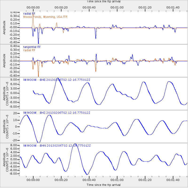
MOOW Moose Ponds, Wyoming, USA - Earthquake Result Viewer
*The percent match for this event was below the threshold and hence no stack was calculated.
| Earthquake location: |
Santa Cruz Islands |
| Earthquake latitude/longitude: |
-11.1/165.4 |
| Earthquake time(UTC): |
2013/02/06 (037) 01:59:33 GMT |
| Earthquake Depth: |
10 km |
| Earthquake Magnitude: |
5.5 MB |
| Earthquake Catalog/Contributor: |
WHDF/NEIC |
|
| Network: |
IW Intermountain West |
| Station: |
MOOW Moose Ponds, Wyoming, USA |
| Lat/Lon: |
43.75 N/110.74 W |
| Elevation: |
2128 m |
|
| Distance: |
93.2 deg |
| Az: |
46.194 deg |
| Baz: |
257.8 deg |
| Ray Param: |
$rayparam |
*The percent match for this event was below the threshold and hence was not used in the summary stack. |
|
| Radial Match: |
86.821495 % |
| Radial Bump: |
325 |
| Transverse Match: |
82.010956 % |
| Transverse Bump: |
400 |
| SOD ConfigId: |
494114 |
| Insert Time: |
2013-05-01 06:09:54.140 +0000 |
| GWidth: |
2.5 |
| Max Bumps: |
400 |
| Tol: |
0.001 |
|
Signal To Noise
| Channel | StoN | STA | LTA |
| IW:MOOW: :BHZ:20130206T02:12:16.775012Z | 1.3302317 | 1.6036649E-5 | 1.2055531E-5 |
| IW:MOOW: :BHN:20130206T02:12:16.775012Z | 0.84633124 | 1.621256E-6 | 1.9156284E-6 |
| IW:MOOW: :BHE:20130206T02:12:16.775012Z | 0.9751033 | 4.4758513E-6 | 4.59013E-6 |
| Arrivals |
| Ps | |
| PpPs | |
| PsPs/PpSs | |


