You are here: Home > Network List > GT - Global Telemetered Seismograph Network (USAF/USGS) Stations List
> Station BGCA Bogoin, Central African Republic > Earthquake Result Viewer
BGCA Bogoin, Central African Republic - Earthquake Result Viewer

| Earthquake location: |
Hindu Kush Region, Afghanistan |
| Earthquake latitude/longitude: |
36.4/70.4 |
| Earthquake time(UTC): |
2002/03/03 (062) 12:08:07 GMT |
| Earthquake Depth: |
209 km |
| Earthquake Magnitude: |
6.3 MB |
| Earthquake Catalog/Contributor: |
WHDF/NEIC |
|
| Network: |
GT Global Telemetered Seismograph Network (USAF/USGS) |
| Station: |
BGCA Bogoin, Central African Republic |
| Lat/Lon: |
5.18 N/18.42 E |
| Elevation: |
676 m |
|
| Distance: |
56.8 deg |
| Az: |
249.715 deg |
| Baz: |
49.423 deg |
| Ray Param: |
0.0632022 |
| Estimated Moho Depth: |
42.5 km |
| Estimated Crust Vp/Vs: |
1.70 |
| Assumed Crust Vp: |
6.642 km/s |
| Estimated Crust Vs: |
3.901 km/s |
| Estimated Crust Poisson's Ratio: |
0.24 |
|
| Radial Match: |
97.47617 % |
| Radial Bump: |
254 |
| Transverse Match: |
87.00808 % |
| Transverse Bump: |
400 |
| SOD ConfigId: |
20082 |
| Insert Time: |
2010-02-27 01:42:05.190 +0000 |
| GWidth: |
2.5 |
| Max Bumps: |
400 |
| Tol: |
0.001 |
|
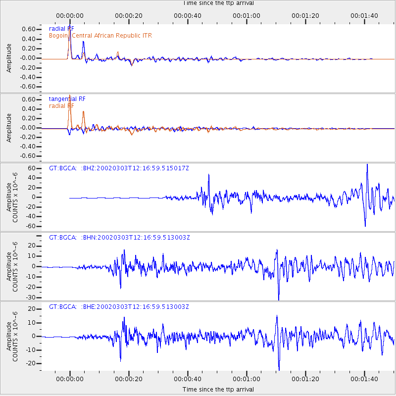
Signal To Noise
| Channel | StoN | STA | LTA |
| GT:BGCA: :BHN:20020303T12:16:59.513003Z | 14.275113 | 5.942352E-7 | 4.1627352E-8 |
| GT:BGCA: :BHE:20020303T12:16:59.513003Z | 6.7430973 | 4.3578453E-7 | 6.4626754E-8 |
| GT:BGCA: :BHZ:20020303T12:16:59.515017Z | 19.28781 | 1.378427E-6 | 7.146623E-8 |
| Arrivals |
| Ps | 4.7 SECOND |
| PpPs | 16 SECOND |
| PsPs/PpSs | 21 SECOND |


