You are here: Home > Network List > TA - USArray Transportable Network (new EarthScope stations) Stations List
> Station Y12C Blythe, CA, USA > Earthquake Result Viewer
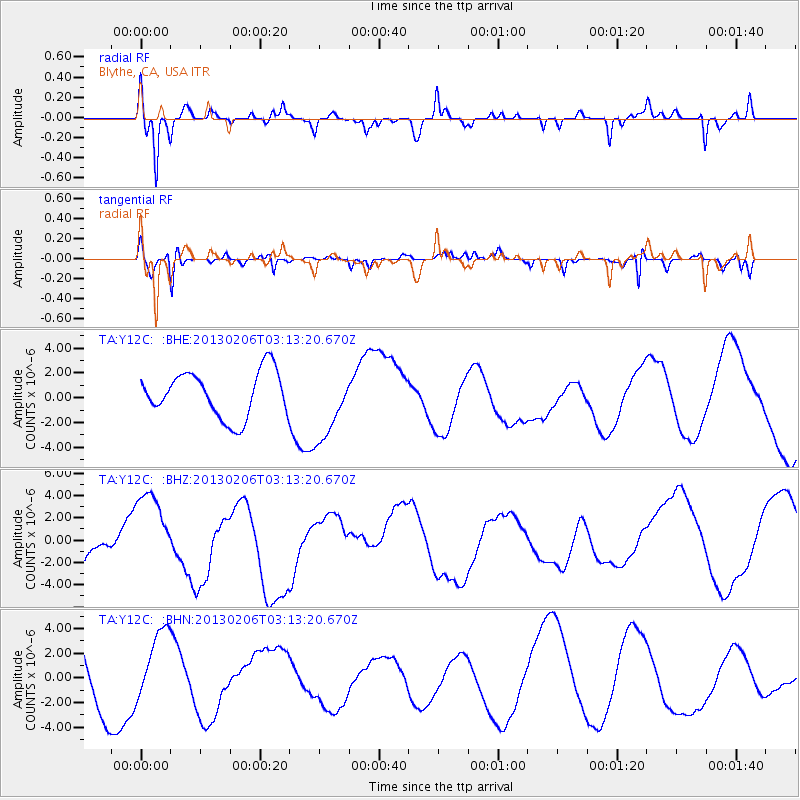
Y12C Blythe, CA, USA - Earthquake Result Viewer
*The percent match for this event was below the threshold and hence no stack was calculated.
| Earthquake location: |
Santa Cruz Islands |
| Earthquake latitude/longitude: |
-11.1/165.1 |
| Earthquake time(UTC): |
2013/02/06 (037) 03:01:01 GMT |
| Earthquake Depth: |
12 km |
| Earthquake Magnitude: |
5.6 MB |
| Earthquake Catalog/Contributor: |
WHDF/NEIC |
|
| Network: |
TA USArray Transportable Network (new EarthScope stations) |
| Station: |
Y12C Blythe, CA, USA |
| Lat/Lon: |
33.75 N/114.52 W |
| Elevation: |
196 m |
|
| Distance: |
88.2 deg |
| Az: |
55.276 deg |
| Baz: |
255.561 deg |
| Ray Param: |
$rayparam |
*The percent match for this event was below the threshold and hence was not used in the summary stack. |
|
| Radial Match: |
79.63524 % |
| Radial Bump: |
335 |
| Transverse Match: |
58.751247 % |
| Transverse Bump: |
282 |
| SOD ConfigId: |
494114 |
| Insert Time: |
2013-05-01 06:32:07.680 +0000 |
| GWidth: |
2.5 |
| Max Bumps: |
400 |
| Tol: |
0.001 |
|
Signal To Noise
| Channel | StoN | STA | LTA |
| TA:Y12C: :BHZ:20130206T03:13:20.670Z | 1.5768548 | 3.986264E-6 | 2.5279842E-6 |
| TA:Y12C: :BHN:20130206T03:13:20.670Z | 0.9470067 | 2.7102233E-6 | 2.861884E-6 |
| TA:Y12C: :BHE:20130206T03:13:20.670Z | 1.5402839 | 2.8299899E-6 | 1.8373171E-6 |
| Arrivals |
| Ps | |
| PpPs | |
| PsPs/PpSs | |


