
BGCA Bogoin, Central African Republic - Earthquake Result Viewer
| ||||||||||||||||||
| ||||||||||||||||||
| ||||||||||||||||||
|
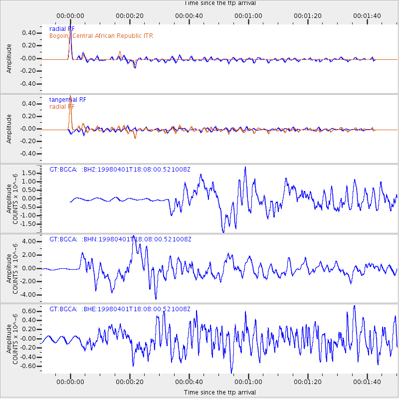
Signal To Noise
| Channel | StoN | STA | LTA |
| GT:BGCA: :BHN:19980401T18:08:00.521008Z | 14.6241865 | 1.0018164E-6 | 6.850407E-8 |
| GT:BGCA: :BHE:19980401T18:08:00.521008Z | 1.5726378 | 9.296616E-8 | 5.9114793E-8 |
| GT:BGCA: :BHZ:19980401T18:08:00.521008Z | 5.946447 | 3.9099325E-7 | 6.575242E-8 |
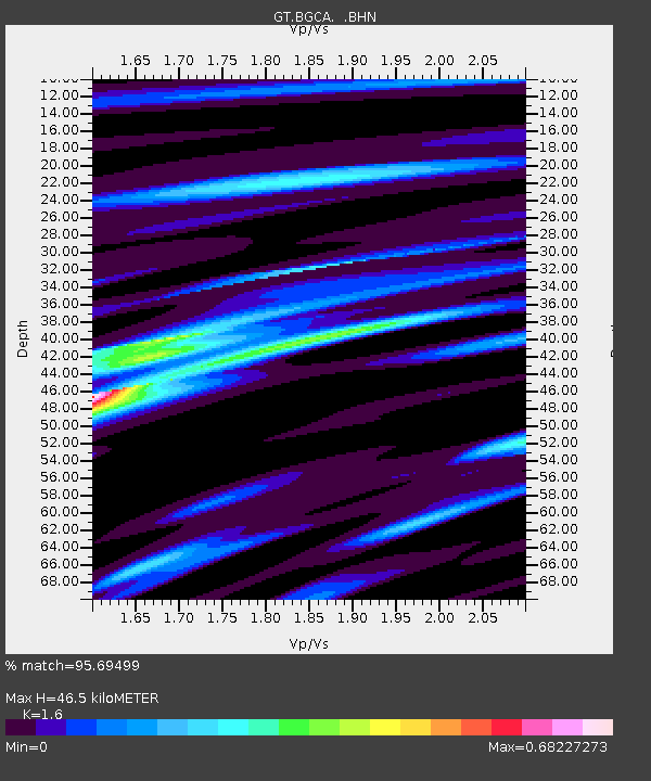
| Arrivals | |
| Ps | 4.3 SECOND |
| PpPs | 18 SECOND |
| PsPs/PpSs | 22 SECOND |

