You are here: Home > Network List > TA - USArray Transportable Network (new EarthScope stations) Stations List
> Station 121A Cookes Peak, Deming, NM, USA > Earthquake Result Viewer
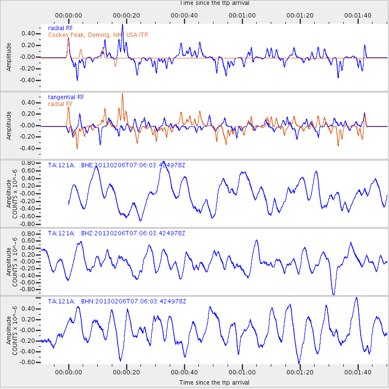
121A Cookes Peak, Deming, NM, USA - Earthquake Result Viewer
*The percent match for this event was below the threshold and hence no stack was calculated.
| Earthquake location: |
Santa Cruz Islands Region |
| Earthquake latitude/longitude: |
-10.6/165.0 |
| Earthquake time(UTC): |
2013/02/06 (037) 06:53:20 GMT |
| Earthquake Depth: |
10 km |
| Earthquake Magnitude: |
5.6 MB, 5.8 MS, 5.9 MW |
| Earthquake Catalog/Contributor: |
WHDF/NEIC |
|
| Network: |
TA USArray Transportable Network (new EarthScope stations) |
| Station: |
121A Cookes Peak, Deming, NM, USA |
| Lat/Lon: |
32.53 N/107.79 W |
| Elevation: |
1652 m |
|
| Distance: |
93.4 deg |
| Az: |
57.694 deg |
| Baz: |
259.604 deg |
| Ray Param: |
$rayparam |
*The percent match for this event was below the threshold and hence was not used in the summary stack. |
|
| Radial Match: |
51.861305 % |
| Radial Bump: |
279 |
| Transverse Match: |
59.51645 % |
| Transverse Bump: |
356 |
| SOD ConfigId: |
494114 |
| Insert Time: |
2013-05-01 06:55:32.403 +0000 |
| GWidth: |
2.5 |
| Max Bumps: |
400 |
| Tol: |
0.001 |
|
Signal To Noise
| Channel | StoN | STA | LTA |
| TA:121A: :BHZ:20130206T07:06:03.424978Z | 1.7898879 | 4.367754E-7 | 2.4402388E-7 |
| TA:121A: :BHN:20130206T07:06:03.424978Z | 1.1579629 | 2.895361E-7 | 2.500392E-7 |
| TA:121A: :BHE:20130206T07:06:03.424978Z | 1.6732439 | 6.125713E-7 | 3.6609802E-7 |
| Arrivals |
| Ps | |
| PpPs | |
| PsPs/PpSs | |


