You are here: Home > Network List > CI - Caltech Regional Seismic Network Stations List
> Station SWS Sam W. Stewart, Westmorland, CA, USA > Earthquake Result Viewer
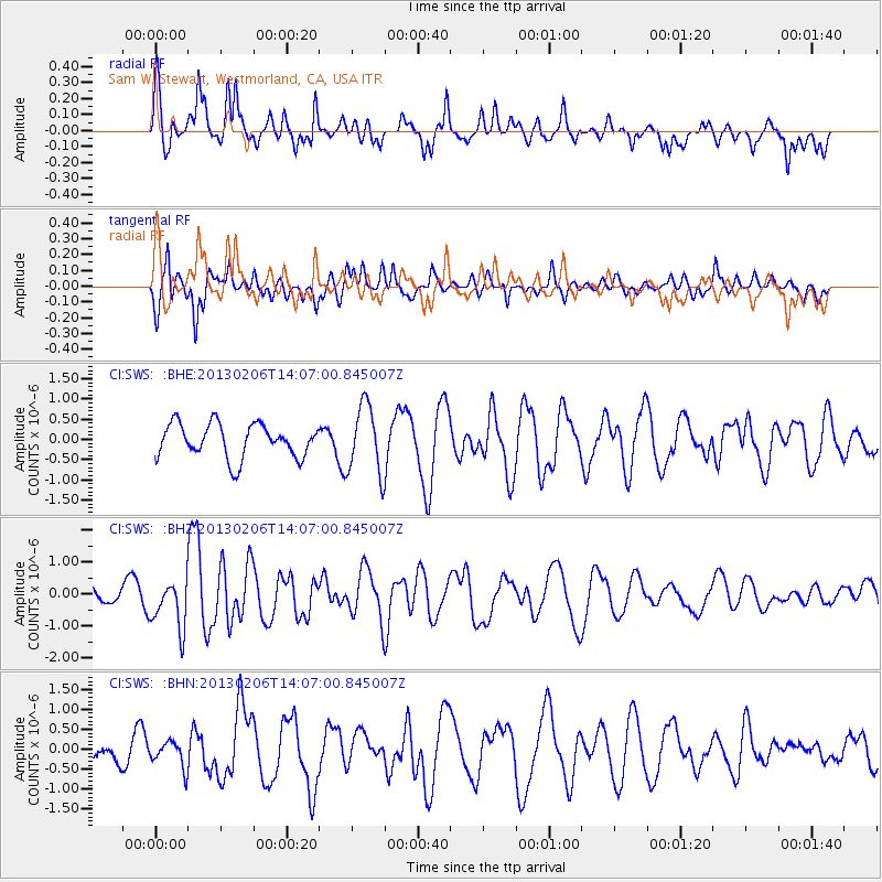
SWS Sam W. Stewart, Westmorland, CA, USA - Earthquake Result Viewer
*The percent match for this event was below the threshold and hence no stack was calculated.
| Earthquake location: |
Santa Cruz Islands |
| Earthquake latitude/longitude: |
-10.8/166.5 |
| Earthquake time(UTC): |
2013/02/06 (037) 13:54:54 GMT |
| Earthquake Depth: |
14 km |
| Earthquake Magnitude: |
6.0 MB, 5.7 MS, 5.8 MW, 5.8 MW |
| Earthquake Catalog/Contributor: |
WHDF/NEIC |
|
| Network: |
CI Caltech Regional Seismic Network |
| Station: |
SWS Sam W. Stewart, Westmorland, CA, USA |
| Lat/Lon: |
32.94 N/115.80 W |
| Elevation: |
140 m |
|
| Distance: |
85.7 deg |
| Az: |
55.474 deg |
| Baz: |
254.282 deg |
| Ray Param: |
$rayparam |
*The percent match for this event was below the threshold and hence was not used in the summary stack. |
|
| Radial Match: |
68.022125 % |
| Radial Bump: |
400 |
| Transverse Match: |
64.46135 % |
| Transverse Bump: |
400 |
| SOD ConfigId: |
494114 |
| Insert Time: |
2013-05-01 07:48:58.824 +0000 |
| GWidth: |
2.5 |
| Max Bumps: |
400 |
| Tol: |
0.001 |
|
Signal To Noise
| Channel | StoN | STA | LTA |
| CI:SWS: :BHZ:20130206T14:07:00.845007Z | 3.034471 | 7.5447036E-7 | 2.4863323E-7 |
| CI:SWS: :BHN:20130206T14:07:00.845007Z | 1.5385082 | 3.2011278E-7 | 2.0806701E-7 |
| CI:SWS: :BHE:20130206T14:07:00.845007Z | 2.0430598 | 8.482559E-7 | 4.15189E-7 |
| Arrivals |
| Ps | |
| PpPs | |
| PsPs/PpSs | |


