You are here: Home > Network List > IC - New China Digital Seismograph Network Stations List
> Station ENH Enshi, Hubei Province, China > Earthquake Result Viewer
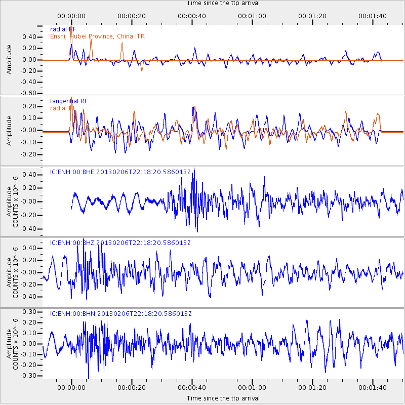
ENH Enshi, Hubei Province, China - Earthquake Result Viewer
*The percent match for this event was below the threshold and hence no stack was calculated.
| Earthquake location: |
Southern Sumatra, Indonesia |
| Earthquake latitude/longitude: |
-1.5/100.3 |
| Earthquake time(UTC): |
2013/02/06 (037) 22:12:17 GMT |
| Earthquake Depth: |
10 km |
| Earthquake Magnitude: |
5.5 MB, 5.4 MS, 5.3 MW |
| Earthquake Catalog/Contributor: |
WHDF/NEIC |
|
| Network: |
IC New China Digital Seismograph Network |
| Station: |
ENH Enshi, Hubei Province, China |
| Lat/Lon: |
30.28 N/109.49 E |
| Elevation: |
500 m |
|
| Distance: |
32.8 deg |
| Az: |
14.803 deg |
| Baz: |
197.173 deg |
| Ray Param: |
$rayparam |
*The percent match for this event was below the threshold and hence was not used in the summary stack. |
|
| Radial Match: |
54.820343 % |
| Radial Bump: |
400 |
| Transverse Match: |
50.89287 % |
| Transverse Bump: |
400 |
| SOD ConfigId: |
494114 |
| Insert Time: |
2013-05-01 07:57:30.826 +0000 |
| GWidth: |
2.5 |
| Max Bumps: |
400 |
| Tol: |
0.001 |
|
Signal To Noise
| Channel | StoN | STA | LTA |
| IC:ENH:00:BHZ:20130206T22:18:20.586013Z | 2.089091 | 2.2175342E-7 | 1.0614828E-7 |
| IC:ENH:00:BHN:20130206T22:18:20.586013Z | 0.8865878 | 7.783382E-8 | 8.7790305E-8 |
| IC:ENH:00:BHE:20130206T22:18:20.586013Z | 1.275937 | 1.00036736E-7 | 7.840257E-8 |
| Arrivals |
| Ps | |
| PpPs | |
| PsPs/PpSs | |


