You are here: Home > Network List > AZ - ANZA Regional Network Stations List
> Station SMER AZ.SMER > Earthquake Result Viewer
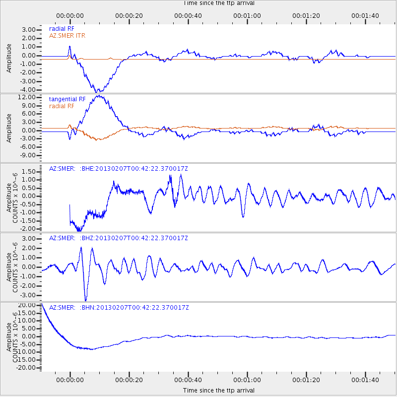
SMER AZ.SMER - Earthquake Result Viewer
*The percent match for this event was below the threshold and hence no stack was calculated.
| Earthquake location: |
Santa Cruz Islands Region |
| Earthquake latitude/longitude: |
-11.7/164.9 |
| Earthquake time(UTC): |
2013/02/07 (038) 00:30:10 GMT |
| Earthquake Depth: |
8.0 km |
| Earthquake Magnitude: |
6.0 MB, 5.9 MS, 6.0 MW, 6.0 MW |
| Earthquake Catalog/Contributor: |
WHDF/NEIC |
|
| Network: |
AZ ANZA Regional Network |
| Station: |
SMER AZ.SMER |
| Lat/Lon: |
33.46 N/117.17 W |
| Elevation: |
355 m |
|
| Distance: |
86.5 deg |
| Az: |
54.979 deg |
| Baz: |
253.67 deg |
| Ray Param: |
$rayparam |
*The percent match for this event was below the threshold and hence was not used in the summary stack. |
|
| Radial Match: |
32.905766 % |
| Radial Bump: |
400 |
| Transverse Match: |
33.401188 % |
| Transverse Bump: |
400 |
| SOD ConfigId: |
494114 |
| Insert Time: |
2013-05-01 08:13:21.743 +0000 |
| GWidth: |
2.5 |
| Max Bumps: |
400 |
| Tol: |
0.001 |
|
Signal To Noise
| Channel | StoN | STA | LTA |
| AZ:SMER: :BHZ:20130207T00:42:22.370017Z | 2.1902885 | 8.94039E-7 | 4.0818318E-7 |
| AZ:SMER: :BHN:20130207T00:42:22.370017Z | 0.40509766 | 8.704214E-6 | 2.1486705E-5 |
| AZ:SMER: :BHE:20130207T00:42:22.370017Z | 1.144528 | 1.0432323E-6 | 9.1149565E-7 |
| Arrivals |
| Ps | |
| PpPs | |
| PsPs/PpSs | |


