You are here: Home > Network List > IW - Intermountain West Stations List
> Station MOOW Moose Ponds, Wyoming, USA > Earthquake Result Viewer
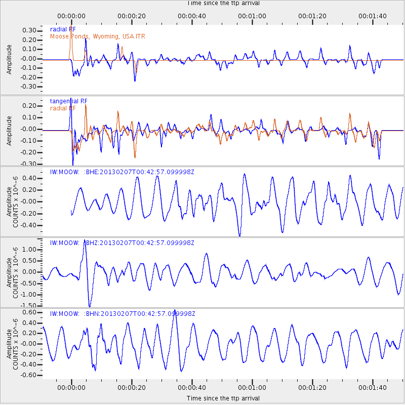
MOOW Moose Ponds, Wyoming, USA - Earthquake Result Viewer
*The percent match for this event was below the threshold and hence no stack was calculated.
| Earthquake location: |
Santa Cruz Islands Region |
| Earthquake latitude/longitude: |
-11.7/164.9 |
| Earthquake time(UTC): |
2013/02/07 (038) 00:30:10 GMT |
| Earthquake Depth: |
8.0 km |
| Earthquake Magnitude: |
6.0 MB, 5.9 MS, 6.0 MW, 6.0 MW |
| Earthquake Catalog/Contributor: |
WHDF/NEIC |
|
| Network: |
IW Intermountain West |
| Station: |
MOOW Moose Ponds, Wyoming, USA |
| Lat/Lon: |
43.75 N/110.74 W |
| Elevation: |
2128 m |
|
| Distance: |
93.9 deg |
| Az: |
46.287 deg |
| Baz: |
257.71 deg |
| Ray Param: |
$rayparam |
*The percent match for this event was below the threshold and hence was not used in the summary stack. |
|
| Radial Match: |
60.989468 % |
| Radial Bump: |
400 |
| Transverse Match: |
54.41415 % |
| Transverse Bump: |
400 |
| SOD ConfigId: |
494114 |
| Insert Time: |
2013-05-01 08:20:08.854 +0000 |
| GWidth: |
2.5 |
| Max Bumps: |
400 |
| Tol: |
0.001 |
|
Signal To Noise
| Channel | StoN | STA | LTA |
| IW:MOOW: :BHZ:20130207T00:42:57.099998Z | 2.5022035 | 5.750246E-7 | 2.2980728E-7 |
| IW:MOOW: :BHN:20130207T00:42:57.099998Z | 0.6301304 | 1.4816693E-7 | 2.3513692E-7 |
| IW:MOOW: :BHE:20130207T00:42:57.099998Z | 1.3029276 | 2.2358259E-7 | 1.7160016E-7 |
| Arrivals |
| Ps | |
| PpPs | |
| PsPs/PpSs | |


